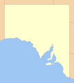
File:South Australia location map.png
Appearance

Size of this preview: 533 × 600 pixels. Other resolutions: 213 × 240 pixels | 552 × 621 pixels.
Original file (552 × 621 pixels, file size: 12 KB, MIME type: image/png)
File history
Click on a date/time to view the file as it appeared at that time.
| Date/Time | Thumbnail | Dimensions | User | Comment | |
|---|---|---|---|---|---|
| current | 11:00, 13 August 2007 |  | 552 × 621 (12 KB) | Roke~commonswiki | modify to use wikiproject maps standard colours |
| 16:46, 17 October 2005 |  | 552 × 621 (12 KB) | Diceman~commonswiki | ||
| 14:36, 21 September 2005 |  | 525 × 582 (17 KB) | Diceman~commonswiki | Created from two Commonwealth of Australia native land title maps and one other map to fill in a missing bit of coastline. Colours to match the USA location map. If this map is targeted for deletion please inform me on the english wikipedia (same user na |
File usage
The following 4 pages use this file:
Global file usage
The following other wikis use this file:
- Usage on de.wikipedia.org
- Usage on ml.wikipedia.org
