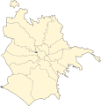
File:Roma municipi locator map.svg
Appearance

Size of this PNG preview of this SVG file: 576 × 600 pixels. Other resolutions: 231 × 240 pixels | 461 × 480 pixels | 738 × 768 pixels | 984 × 1,024 pixels | 1,967 × 2,048 pixels | 1,319 × 1,373 pixels.
Original file (SVG file, nominally 1,319 × 1,373 pixels, file size: 533 KB)
File history
Click on a date/time to view the file as it appeared at that time.
| Date/Time | Thumbnail | Dimensions | User | Comment | |
|---|---|---|---|---|---|
| current | 20:56, 4 October 2021 |  | 1,319 × 1,373 (533 KB) | Sannita | updating map (zone 8A is now in 7th municipality) |
| 21:32, 29 May 2020 |  | 1,363 × 1,420 (542 KB) | Sannita | better scale | |
| 14:22, 23 May 2020 |  | 800 × 833 (555 KB) | Sannita | better border highlight | |
| 14:06, 23 May 2020 |  | 800 × 833 (555 KB) | Sannita | fixing borders and object names | |
| 01:10, 22 April 2020 |  | 1,348 × 1,439 (145 KB) | Sannita | Uploaded own work with UploadWizard |
File usage
The following 17 pages use this file:
Global file usage
The following other wikis use this file:
- Usage on ko.wikipedia.org
