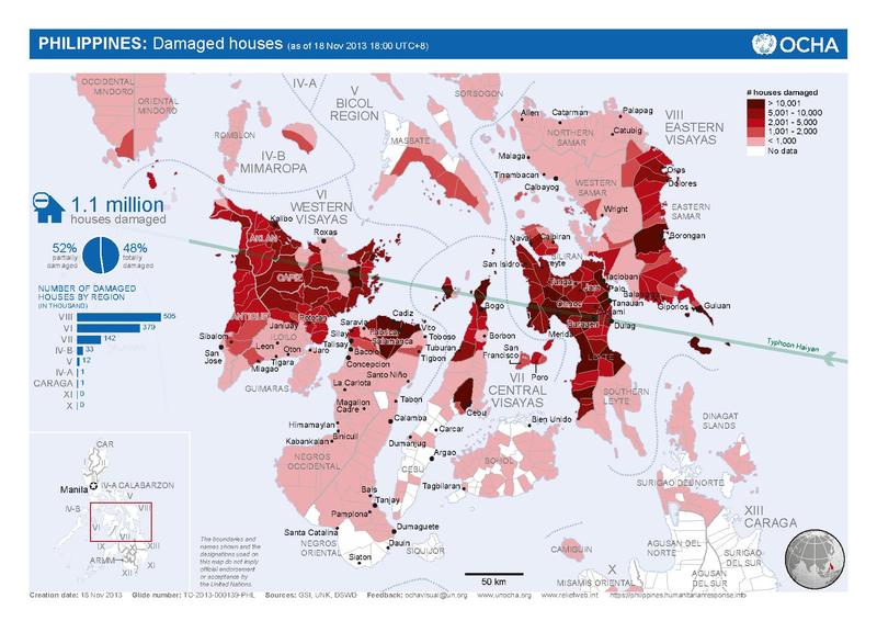
File:ReliefNet Map of Damaged houses Typhoon Haiyan.pdf
Appearance

Size of this JPG preview of this PDF file: 800 × 566 pixels. Other resolutions: 320 × 226 pixels | 640 × 453 pixels | 1,024 × 724 pixels | 1,280 × 905 pixels | 1,752 × 1,239 pixels.
Original file (1,752 × 1,239 pixels, file size: 2.4 MB, MIME type: application/pdf)
File history
Click on a date/time to view the file as it appeared at that time.
| Date/Time | Thumbnail | Dimensions | User | Comment | |
|---|---|---|---|---|---|
| current | 01:58, 19 November 2013 |  | 1,752 × 1,239 (2.4 MB) | Iloilo Wanderer | {{subst:Upload marker added by en.wp UW}} {{Information |Description = {{en|Map of houses damaged in the Philippines, by municipality, during Typhoon Haiyan / Yolanda, provided by the United Nations, via ReliefNet. http://reliefweb.int/map/philippines/... |
File usage
The following 2 pages use this file:
Global file usage
The following other wikis use this file:
- Usage on es.wikipedia.org
- Usage on no.wikipedia.org
- Usage on zh.wikipedia.org

