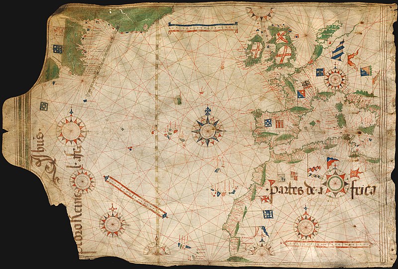
File:Pedro Reinel 1504.jpg
Appearance

Size of this preview: 800 × 541 pixels. Other resolutions: 320 × 216 pixels | 640 × 433 pixels | 1,024 × 693 pixels | 1,280 × 866 pixels | 2,560 × 1,732 pixels | 3,418 × 2,312 pixels.
Original file (3,418 × 2,312 pixels, file size: 6 MB, MIME type: image/jpeg)
| This is a featured picture, which means that members of the community have identified it as one of the finest images on the English Wikipedia, adding significantly to its accompanying article. If you have a different image of similar quality, be sure to upload it using the proper free license tag, add it to a relevant article, and nominate it. |
| This image was selected as picture of the day on the English Wikipedia for June 18, 2009. |
File history
Click on a date/time to view the file as it appeared at that time.
| Date/Time | Thumbnail | Dimensions | User | Comment | |
|---|---|---|---|---|---|
| current | 20:40, 11 October 2008 |  | 3,418 × 2,312 (6 MB) | Alvesgaspar | {{Information |Description=Portuguese nautical chart by Pedro Reinel, c. 1504 |Source=Bayerische Staatsbibliothek, Munchen |Date=c. 1504 |Author=Pedro Reinel |Permission=below |other_versions= }} Category:Photos by Alvesgaspar Category:Old charts |
File usage
The following 19 pages use this file:
- History of cartography
- Pedro Reinel
- Portuguese Renaissance
- User:Alvesgaspar
- User:Peter Mercator/Map gallery
- User talk:Alvesgaspar/archive1
- Wikipedia:Featured picture candidates/Image:Pedro Reinel 1504.jpg
- Wikipedia:Featured picture candidates/October-2008
- Wikipedia:Featured pictures/Diagrams, drawings, and maps/Maps
- Wikipedia:Featured pictures thumbs/13
- Wikipedia:GLAM/NHMandSM/booklet
- Wikipedia:Picture of the day/June 2009
- Wikipedia:Wikipedia Signpost/2008-11-08/Features and admins
- Wikipedia:Wikipedia Signpost/2008-11-08/SPV
- Wikipedia:Wikipedia Signpost/Single/2008-11-08
- Template:POTD/2009-06-18
- Portal:Maps
- Portal:Maps/Selected picture
- Portal:Maps/Selected picture/46
Global file usage
The following other wikis use this file:
- Usage on bn.wikipedia.org
- Usage on ca.wikipedia.org
- Usage on crh.wikipedia.org
- Usage on cs.wikipedia.org
- Usage on cv.wikipedia.org
- Usage on de.wikipedia.org
- Usage on en.wiktionary.org
- Usage on eo.wikipedia.org
- Vikipedio:Bildo de la tago/2009 01
- Vikipedio:Bildo de la tago/2009 02
- Pedro Reinel
- Vikipedio:Bildo de la tago/2011 02
- Vikipedio:Bildo de la tago/2011 01
- Vikipedio:Bildo de la tago/2010 02
- Vikipedio:Bildo de la tago/2010 01
- Vikipedio:Bildo de la tago/2012 02
- Vikipedio:Bildo de la tago/2012 01
- Vikipedio:Bildo de la tago2/indekso/3
- Ŝablono:Bildo de la Tago2/128
- Usage on es.wikipedia.org
- Usage on es.wiktionary.org
- Usage on fi.wikipedia.org
- Usage on fr.wikipedia.org
- Usage on fr.wiktionary.org
- Usage on gl.wikipedia.org
- Usage on hr.wikipedia.org
- Usage on hu.wikipedia.org
- Usage on it.wikipedia.org
- Usage on ko.wikipedia.org
- Usage on lbe.wikipedia.org
- Usage on nl.wikipedia.org
- Usage on os.wikipedia.org
- Usage on pl.wikipedia.org
View more global usage of this file.


