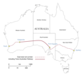
File:Map of Australia's east-west rail corridor.png
Appearance

Size of this preview: 755 × 600 pixels. Other resolutions: 302 × 240 pixels | 604 × 480 pixels | 967 × 768 pixels | 1,280 × 1,017 pixels | 2,560 × 2,034 pixels | 2,699 × 2,144 pixels.
Original file (2,699 × 2,144 pixels, file size: 685 KB, MIME type: image/png)
File history
Click on a date/time to view the file as it appeared at that time.
| Date/Time | Thumbnail | Dimensions | User | Comment | |
|---|---|---|---|---|---|
| current | 09:58, 13 September 2023 |  | 2,699 × 2,144 (685 KB) | SCHolar44 | (By original uploader): Add extra source details; mark broad gauge; minor re-wording |
| 04:47, 1 March 2022 |  | 1,798 × 1,428 (371 KB) | SCHolar44 | Amended ambiguous words in 1927-1970 note | |
| 03:12, 1 March 2022 |  | 1,798 × 1,428 (363 KB) | SCHolar44 | By original uploader: route re-drawn to scale, added pre-1970 corridor and more detail | |
| 10:50, 4 July 2020 |  | 1,753 × 1,618 (356 KB) | SCHolar44 | Added names of other significant points; added to key. | |
| 11:09, 15 April 2020 |  | 2,645 × 2,401 (570 KB) | SCHolar44 | Uploaded own work with UploadWizard |
File usage
The following page uses this file:
Global file usage
The following other wikis use this file:
- Usage on hi.wikibooks.org
- Usage on ru.wikipedia.org
