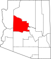
File:Map of Arizona highlighting Yavapai County.svg
Appearance

Size of this PNG preview of this SVG file: 487 × 599 pixels. Other resolutions: 195 × 240 pixels | 390 × 480 pixels | 624 × 768 pixels | 832 × 1,024 pixels | 1,664 × 2,048 pixels | 893 × 1,099 pixels.
Original file (SVG file, nominally 893 × 1,099 pixels, file size: 260 KB)
File history
Click on a date/time to view the file as it appeared at that time.
| Date/Time | Thumbnail | Dimensions | User | Comment | |
|---|---|---|---|---|---|
| current | 22:10, 28 February 2015 |  | 893 × 1,099 (260 KB) | Sumiaz | Newer version based on File:USA Arizona location map.svg |
| 10:08, 12 February 2006 |  | 5,453 × 6,322 (56 KB) | David Benbennick | {{subst:User:Dbenbenn/clm|county=Yavapai County|state=Arizona}} |
File usage
The following 94 pages use this file:
- Alexandra, Arizona
- Ash Fork, Arizona
- Aultman, Arizona
- Bagdad, Arizona
- Beaver Creek Ranger Station
- Big Bug, Arizona
- Black Canyon City, Arizona
- Bradshaw City, Arizona
- Breezy Pines, Arizona
- Briggs, Arizona
- Bumble Bee, Arizona
- Camp Verde, Arizona
- Catoctin, Arizona
- Cherry, Arizona
- Chino Valley, Arizona
- Clarkdale, Arizona
- Clarkdale Historic District (Clarkdale, Arizona)
- Cleator, Arizona
- Columbia, Arizona
- Congress, Arizona
- Constellation, Arizona
- Copperopolis, Arizona
- Cordes, Arizona
- Cordes Lakes, Arizona
- Cornville, Arizona
- Cottonwood, Arizona
- Crown King, Arizona
- Dewey–Humboldt, Arizona
- Drake, Arizona
- Dugas, Arizona
- Entro, Arizona
- Forbing Park, Arizona
- Fort Misery, Arizona
- Gillett, Arizona
- Glen Oaks, Arizona
- Goodwin, Arizona
- Groom Creek, Arizona
- Hecla, Arizona
- Highland Park, Yavapai County, Arizona
- Hillside, Arizona
- Hooper, Arizona
- Hualapai
- Humbug, Arizona
- Iron Springs, Arizona
- Jerome, Arizona
- Jerome Historic District
- Jerome Junction, Arizona
- Juniper Heights, Arizona
- Kirkland, Arizona
- Lake Montezuma, Arizona
- Lapham, Arizona
- List of counties in Arizona
- Mayer, Arizona
- Minnehaha, Arizona
- Montezuma Castle National Monument
- National Register of Historic Places listings in Prescott, Arizona
- National Register of Historic Places listings in Yavapai County, Arizona
- Nelson, Yavapai County, Arizona
- Oak Creek, Arizona
- Octave, Arizona
- Paulden, Arizona
- Peeples Valley, Arizona
- Peoria, Arizona
- Perkinsville, Arizona
- Potato Patch, Arizona
- Prescott, Arizona
- Prescott Valley, Arizona
- Red Rock, Yavapai County, Arizona
- Sedona, Arizona
- Seligman, Arizona
- Skull Valley, Arizona
- Spring Valley, Arizona
- Stanton, Arizona
- Tip Top, Arizona
- Venezia, Arizona
- Verde Village, Arizona
- Village of Oak Creek, Arizona
- Wagoner, Arizona
- Walker, Arizona
- Walnut Grove, Arizona
- Weaver, Arizona
- Wilhoit, Arizona
- Williamson, Arizona
- Yarnell, Arizona
- Yava, Arizona
- Yavapai-Prescott Tribe
- Yavapai County, Arizona
- Yavapai County Sheriff's Office
- Yavapai–Apache Nation
- User:AridCeption/sandbox
- User:Nyttend/County templates/AZ
- File talk:Map of Arizona highlighting Yavapai County.svg
- Template:Yavapai County, Arizona
- Category:Populated places in Yavapai County, Arizona
Global file usage
The following other wikis use this file:
- Usage on ar.wikipedia.org
- قائمة مقاطعات أريزونا
- مقاطعة يافاباي (أريزونا)
- بغداد (أريزونا)
- بيوريا
- بريسكوت (أريزونا)
- شينو فالي
- بريسكوت فالي
- سيدونا
- كامب فيردي (أريزونا)
- كلاركديل (أريزونا)
- ديوي هومبولت (أريزونا)
- جيروم (أريزونا)
- ويكنبورغ (أريزونا)
- كوتنوود
- كونغرس (أريزونا)
- ويليامسون (أريزونا)
- سبرينغ فالي (أريزونا)
- بيبلس فالي (أريزونا)
- بلاك كانيون (أريزونا)
- ماير (أريزونا)
- لاك مونتيزوما (أريزونا)
- كوردز ليكس (أريزونا)
- قالب:مقاطعة يافاباي (أريزونا)
- سيليغمان (أريزونا)
- ويلهويت (أريزونا)
- آش فورك (أريزونا)
- باولدن (أريزونا)
- Usage on bg.wikipedia.org
- Usage on bpy.wikipedia.org
- Usage on ca.wikipedia.org
View more global usage of this file.
