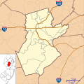
File:Location map of Somerset County, New Jersey.svg
Appearance

Size of this PNG preview of this SVG file: 600 × 600 pixels. Other resolutions: 240 × 240 pixels | 480 × 480 pixels | 768 × 768 pixels | 1,024 × 1,024 pixels | 2,048 × 2,048 pixels.
Original file (SVG file, nominally 768 × 768 pixels, file size: 354 KB)
File history
Click on a date/time to view the file as it appeared at that time.
| Date/Time | Thumbnail | Dimensions | User | Comment | |
|---|---|---|---|---|---|
| current | 22:55, 10 January 2023 |  | 768 × 768 (354 KB) | X5163x | Merged Princeton Township and Borough (was merged since 2013) |
| 15:37, 20 September 2012 |  | 768 × 768 (355 KB) | Omnedon | ||
| 15:34, 20 September 2012 |  | 768 × 768 (350 KB) | Omnedon | ||
| 14:20, 16 September 2012 |  | 768 × 768 (305 KB) | Omnedon | ||
| 00:06, 29 August 2012 |  | 768 × 768 (272 KB) | Omnedon | == {{int:filedesc}} == {{Information |Description={{en|This is a map of Somerset County, New Jersey, USA.}} |Source=My own work, using custom-written [http://mapserver.org/mapscript/ MapScript] applications with [http... |
File usage
More than 100 pages use this file. The following list shows the first 100 pages that use this file only. A full list is available.
- Andrew Ten Eyck House
- Basking Ridge, New Jersey
- Bedminster, New Jersey
- Belle Mead, New Jersey
- Bernards Township, New Jersey
- Bernardsville, New Jersey
- Blackwells Mills, New Jersey
- Blawenburg, New Jersey
- Bound Brook, New Jersey
- Bradley Gardens, New Jersey
- Branchburg, New Jersey
- Brick Academy
- Bridgewater Township, New Jersey
- Brook Arts Center
- Clyde, New Jersey
- Duke Farms
- Dutchtown, Somerset County, New Jersey
- East Franklin, New Jersey
- East Millstone, New Jersey
- East Rocky Hill, New Jersey
- Far Hills, New Jersey
- Finderne, New Jersey
- Flagtown, New Jersey
- Franklin Center, New Jersey
- Franklin Park, New Jersey
- Franklin Township, Somerset County, New Jersey
- General John Frelinghuysen House
- Gladstone, New Jersey
- Green Brook Township, New Jersey
- Green Knoll, New Jersey
- Griggstown, New Jersey
- Harlingen, New Jersey
- Hillsborough Township, New Jersey
- Hutcheson Memorial Forest
- Jacobus Vanderveer House
- James B. Christie House
- Kingston Bridge (Kingston, New Jersey)
- Kingston Mill Historic District
- Lamington, New Jersey
- Lamington Black Cemetery
- Lamington River
- Liberty Corner, New Jersey
- Lyons, New Jersey
- Manville, New Jersey
- Martinsville, New Jersey
- Middle Brook (Raritan River tributary)
- Middlebrook, New Jersey
- Middlebrook encampment
- Middlebush, New Jersey
- Middlebush Reformed Church
- Middlebush Village Historic District
- Millstone, New Jersey
- Millstone Historic District
- Moggy Hollow Natural Area
- Montgomery Township, New Jersey
- Mount Bethel Baptist Meetinghouse
- Neshanic, New Jersey
- Neshanic Station, New Jersey
- Nevius Street Bridge
- North Branch, New Jersey
- North Branch Reformed Church
- North Plainfield, New Jersey
- Old Dutch Parsonage
- Old Stone Arch Bridge (Bound Brook, New Jersey)
- Peapack-Gladstone, New Jersey
- Pleasant Plains, New Jersey
- Pluckemin, New Jersey
- Pluckemin Continental Artillery Cantonment Site
- Pluckemin Village Historic District
- Pottersville, New Jersey
- Presbyterian Church at Bound Brook
- Presbyterian Church in Basking Ridge
- Raritan, New Jersey
- Reformed Dutch Church of Blawenburg
- Relief Hose Company No. 2 Engine House
- Rockingham (house)
- Rocky Hill, New Jersey
- Rocky Hill Historic District
- Six Mile Run, New Jersey
- Six Mile Run Reformed Church
- Skillman, New Jersey
- Somerset, New Jersey
- Somerset County Courthouse (New Jersey)
- Somerville, New Jersey
- South Bound Brook, New Jersey
- South Branch, New Jersey
- St. Bernard's Church and Parish House
- Staats House (South Bound Brook, New Jersey)
- Stoutsburg, New Jersey
- Ten Mile Run, New Jersey
- Tulipwood (Somerset, New Jersey)
- Van Wickle House
- Voorhees (CDP), New Jersey
- Wallace House (Somerville, New Jersey)
- Warren Township, New Jersey
- Washington Rock State Park
- Watchung, New Jersey
- West End Hose Company Number 3
- Weston, New Jersey
- Zarephath, New Jersey
View more links to this file.
Global file usage
The following other wikis use this file:
- Usage on ar.wikipedia.org
- Usage on azb.wikipedia.org
- مدیلبوش، نیوجرسی
- پلیزنت پلینز، نیوجرسی
- لمینقتون، نیوجرسی
- فلاقتاون، نیوجرسی
- بلکولز میلز، نیوجرسی
- فرانکلین پارک، نیوجرسی
- تن مایل ران، نیوجرسی
- بسکینق ریج، نیوجرسی
- مارتینزویل، نیوجرسی
- فرنکلین سنتر، نیوجرسی
- قلادستون، نیوجرسی
- اسکیلمن، نیوجرسی
- واتسون، نیوجرسی
- ایست فرانکلین، نیوجرسی
- قرین نول، نیوجرسی
- بردلی قاردنز، نیوجرسی
- فایندرن، نیوجرسی
- ایست راکی هیل، نیوجرسی
- بل مد، نیوجرسی
- وورهیز ، نیوجرسی
- هارلینقتون، نیوجرسی
- بلائنبرق، نیوجرسی
- زارفت، نیوجرسی
- کلاید، نیوجرسی
- پلوکمین، نیوجرسی
- زیون، نیوجرسی
- لیونز، نیوجرسی
- میدلبروک، نیوجرسی
- Usage on ceb.wikipedia.org
- Usage on fa.wikipedia.org
- الگو:Location map USA New Jersey Somerset County
- اسکیلمن، نیوجرسی
- بل مد، نیوجرسی
- هارلینگتون، نیوجرسی
- بسکینگ ریج، نیوجرسی
- پلیزنت پلینز، نیوجرسی
- مارتینزویل، نیوجرسی
- بلکولز میلز، نیوجرسی
- فرانکلین پارک، نیوجرسی
- مدیلبوش، نیوجرسی
- بلائنبرگ، نیوجرسی
- بردلی گاردنز، نیوجرسی
- کلاید، نیوجرسی
- زارفت، نیوجرسی
- گرین نول، نیوجرسی
- ایست راکی هیل، نیوجرسی
- ایست فرانکلین، نیوجرسی
- گلادستون، نیوجرسی
- فرنکلین سنتر، نیوجرسی
- تن مایل ران، نیوجرسی
View more global usage of this file.
