Dutchtown, Somerset County, New Jersey
Appearance
Dutchtown, New Jersey | |
|---|---|
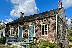
 Dirck Gulick House, listed on the NRHP | |
| Coordinates: 40°26′52″N 74°41′24″W / 40.44778°N 74.69000°W | |
| Country | |
| State | |
| County | Somerset |
| Township | Montgomery |
| Elevation | 112 ft (34 m) |
| GNIS feature ID | 876021[1] |

Dutchtown is an unincorporated community located within Montgomery Township in Somerset County, in the U.S. state of New Jersey.[2] The area consists mainly of forested land with some houses grouped around the intersection of Dutchtown-Zion Road and Belle Mead-Blawenberg Road (County Route 601) in the northern portion of the township. Also nearby are the Unionville Cemetery and a rock quarry.[3] The Dirck Gulick House was added to the National Register of Historic Places in 2003.[4]
References
[edit]- ^ a b "Dutchtown". Geographic Names Information System. United States Geological Survey, United States Department of the Interior.
- ^ Locality Search, State of New Jersey. Accessed February 15, 2015.
- ^ "Aerial view of Dutchtown" (Map). Google Maps. Retrieved January 14, 2016.
- ^ Brecknell, Ursula G. (November 2002). "National Register of Historic Places Inventory/Nomination: Dirck Gulick House". National Park Service. With accompanying 11 photos


