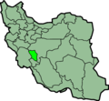
File:IranChaharMahaalBakhtiari.png
Appearance

Size of this preview: 648 × 599 pixels. Other resolutions: 260 × 240 pixels | 519 × 480 pixels | 879 × 813 pixels.
Original file (879 × 813 pixels, file size: 25 KB, MIME type: image/png)
File history
Click on a date/time to view the file as it appeared at that time.
| Date/Time | Thumbnail | Dimensions | User | Comment | |
|---|---|---|---|---|---|
| current | 23:42, 23 June 2013 |  | 879 × 813 (25 KB) | BasilLeaf | بروزرسانی مرز بین استانهای یزد و خراسان جنوبی، تهران و البرز، فارس و یزد و اصفهان |
| 11:41, 12 November 2010 |  | 879 × 813 (41 KB) | M samadi | Border of some provinces updated. | |
| 12:56, 13 October 2010 |  | 697 × 614 (108 KB) | Amin19850 | Tehran & Alborz Province is divided | |
| 23:03, 9 March 2007 |  | 697 × 614 (95 KB) | KureCewlik81 | ||
| 21:10, 8 November 2006 |  | 200 × 185 (10 KB) | Raymond | transparent background, improved color palette | |
| 21:53, 15 September 2005 |  | 200 × 185 (20 KB) | Kotoito | Province of Chahar-Mahal and Bakhtiyari, Iran Created by Morwen |
File usage
More than 100 pages use this file. The following list shows the first 100 pages that use this file only. A full list is available.
- Ab Talkhak
- Ali Asgar, Chaharmahal and Bakhtiari
- Aluni
- Ardal
- Azizabad-e Olya
- Azizabad-e Sofla
- Babaheydar
- Bazoft District
- Ben, Iran
- Bohlulabad, Chaharmahal and Bakhtiari
- Boldaji
- Boldaji District
- Buger
- Central District (Ardal County)
- Central District (Borujen County)
- Central District (Farsan County)
- Central District (Kiar County)
- Central District (Kuhrang County)
- Central District (Lordegan County)
- Central District (Shahrekord County)
- Chelgerd
- Chendeh
- Chuleh Dan
- Darreh Dun, Chaharmahal and Bakhtiari
- Darreh Qahti
- Darreh Shur, Ardal
- Darreh Shur, Miankuh
- Deh-e Azizi Gandomkar-e Vosta
- Deh-e Khalili
- Deh Kohneh-ye Halu Saad
- Dehnow, Ardal
- Dinaran Rural District
- Durak Qanbari
- Durak Rahman
- Emamzadeh Esmail, Chaharmahal and Bakhtiari
- Eslamabad, Ardal
- Falard District
- Faradonbeh
- Farrokh Shahr
- Farsan
- Gahru
- Gandoman
- Gandoman District
- Gandomkar-e Olya
- Gandomkar-e Sofla
- Gavzalak
- Gel-e Shur
- Hardan, Chaharmahal and Bakhtiari
- Kahidan
- Kanemi
- Khanmirza County
- Kian, Iran
- Landi, Iran
- Laran District
- Lepir
- Lordegan
- Mahrik
- Mal-e Khalifeh
- Malek Shir
- Manj District
- Miankuh District
- Miankuh Rural District (Ardal County)
- Nafech
- Naghan
- Naghan District
- Naqneh
- Nokhodkar
- Pahna
- Poshtkuh Rural District (Ardal County)
- Qaidan, Chaharmahal and Bakhtiari
- Refen
- Saman, Chaharmahal and Bakhtiari
- Sar Boneh
- Sar Khun, Chaharmahal and Bakhtiari
- Sar Mazeh
- Sar Qaleh, Ardal
- Sarreh Zard
- Sefiddasht
- Shahrak-e Kazamiyeh
- Shahrak-e Shiasi
- Shahrekord Shahid Estaki International Airport
- Shalamzar
- Shalil Rural District
- Sharmak
- Sudjan
- Sureshjan
- Tall Tak
- Taqanak
- Tavalledan
- Vaqfi, Chaharmahal and Bakhtiari
- Var-e Zard
- Yan Cheshmeh
- Zard-Kuh
- User:AlexNebraska/Images of Iran
- Template:Ardal-geo-stub
- Template:Borujen-geo-stub
- Template:ChaharmahalBakhtiari-geo-stub
- Template:Farsan-geo-stub
- Template:Kiar-geo-stub
- Template:Kuhrang-geo-stub
View more links to this file.
Global file usage
The following other wikis use this file:
- Usage on ar.wikipedia.org
- Usage on arz.wikipedia.org
- Usage on az.wikipedia.org
- Usage on bn.wikipedia.org
- Usage on ca.wikipedia.org
- Usage on ceb.wikipedia.org
- Usage on ckb.wikipedia.org
- Usage on da.wikipedia.org
- Usage on el.wikipedia.org
- Usage on eo.wikipedia.org
- Usage on fa.wikinews.org
- Usage on glk.wikipedia.org
- Usage on hi.wikipedia.org
- Usage on hr.wikipedia.org
- Usage on hu.wikipedia.org
- Usage on id.wikipedia.org
- Usage on incubator.wikimedia.org
- Usage on it.wikipedia.org
- Provincia di Chahar Mahal e Bakhtiari
- Province dell'Iran
- Template:Provincia di Chahar Mahal e Bakhtiari
- Shahrestān di Ardal
- Shahrestān di Borujen
- Shahrestān di Farsan
- Shahrestān di Kuhrang
- Shahrestān di Lordegan
- Shahrestān di Shahr-e Kord
- Shahrestān di Kiar
- Shahrekord
- Ardal (Iran)
- Borujen
- Boldaji
- Gandoman
- Faradonbeh
- Farsan
- Baba Heydar
- Juneqan
- Shalamzar
View more global usage of this file.


