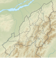
File:India Nagaland relief map.svg
Appearance

Size of this PNG preview of this SVG file: 649 × 599 pixels. Other resolutions: 260 × 240 pixels | 520 × 480 pixels | 832 × 768 pixels | 1,109 × 1,024 pixels | 2,218 × 2,048 pixels | 889 × 821 pixels.
Original file (SVG file, nominally 889 × 821 pixels, file size: 1.58 MB)
File history
Click on a date/time to view the file as it appeared at that time.
| Date/Time | Thumbnail | Dimensions | User | Comment | |
|---|---|---|---|---|---|
| current | 04:16, 17 April 2022 |  | 889 × 821 (1.58 MB) | C1MM | Added four new districts |
| 05:04, 21 May 2021 |  | 889 × 821 (1.66 MB) | C1MM | Corrected districts and river boundaries | |
| 03:18, 17 December 2020 |  | 646 × 669 (922 KB) | C1MM | Changed image colours | |
| 05:47, 24 October 2020 |  | 646 × 669 (3.27 MB) | C1MM | Uploaded a work by Own work based on Nzeemin from Derivative of India Nagaland location map.png with UploadWizard |
File usage
The following 13 pages use this file:
- Fakim Wildlife Sanctuary
- Kapamüdzü
- Khonoma Nature Conservation and Tragopan Sanctuary
- Lake Shilloi
- Mount Japfü
- Mount Khülio-King
- Mount Saramati
- Pulie Badze
- Pulie Badze Wildlife Sanctuary
- Teyozwü Hill
- Module:Location map/data/India Nagaland
- Module:Location map/data/India Nagaland/doc
- Module talk:Location map/data/India Nagaland
Global file usage
The following other wikis use this file:
- Usage on bh.wikipedia.org
- Usage on es.wikipedia.org
- Usage on or.wikipedia.org
- Usage on pa.wikipedia.org
- Usage on si.wikipedia.org
- Usage on te.wikipedia.org
