File:Hautes-Fagnes.jpg
Appearance

Size of this preview: 800 × 600 pixels. Other resolutions: 320 × 240 pixels | 640 × 480 pixels | 1,024 × 768 pixels | 1,280 × 960 pixels | 2,272 × 1,704 pixels.
Original file (2,272 × 1,704 pixels, file size: 1.93 MB, MIME type: image/jpeg)
File history
Click on a date/time to view the file as it appeared at that time.
| Date/Time | Thumbnail | Dimensions | User | Comment | |
|---|---|---|---|---|---|
| current | 21:40, 30 September 2005 |  | 2,272 × 1,704 (1.93 MB) | Elya | Reverted to earlier revision |
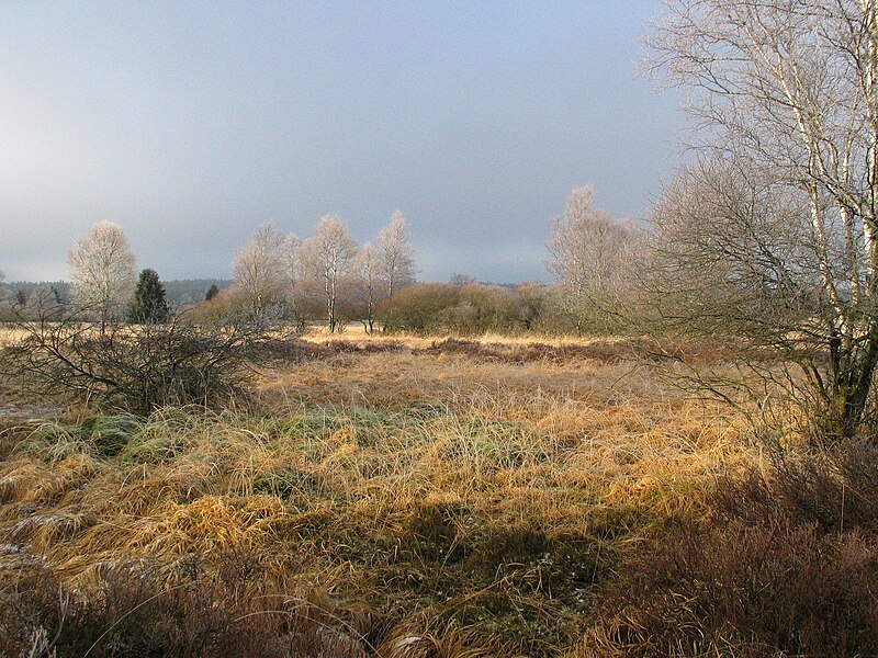
| 09:18, 27 March 2005 |  | 2,272 × 1,704 (1.93 MB) | Aline~commonswiki | Self-made picture, end of December 2004. Typical landscape of the Hautes Fagnes, in East-Belgium, near the German border. Locality of Kutenhart, near Brackvenn (between Eupen -BE- and Monschau -DE-, near the village of Mützenich -DE-). License : GNU FD |
File usage
The following 9 pages use this file:
Global file usage
The following other wikis use this file:
- Usage on af.wikipedia.org
- Usage on ast.wikipedia.org
- Usage on az.wikipedia.org
- Usage on bn.wikipedia.org
- Usage on bn.wikibooks.org
- Usage on ca.wikipedia.org
- Usage on ceb.wikipedia.org
- Usage on cs.wikipedia.org
- Usage on da.wikipedia.org
- Usage on de.wikipedia.org
- Ardennen
- Deutschsprachige Gemeinschaft
- Herzogtum Limburg
- Moorlandschaft
- Europäisches Diplom für geschützte Gebiete
- Portal:Belgien
- Naturpark Hohes Venn-Eifel
- Portal:Belgien/Titel
- Portal:Belgien/Ausgezeichnete Artikel
- Portal:Belgien/Mitmachen
- Eifel-Höhen-Route
- Welterbe in Belgien
- Benutzer:Mimid/PMR
- Benutzer:Mimid/PMR/Titel
- Liste der Ramsar-Gebiete in Belgien
- Usage on de.wikivoyage.org
- Usage on el.wikipedia.org
- Usage on en.wikibooks.org
- Usage on en.wiktionary.org
- Usage on eo.wikipedia.org
- Usage on es.wikipedia.org
- Usage on eu.wikipedia.org
- Usage on fa.wikipedia.org
- Usage on fr.wikipedia.org
View more global usage of this file.

