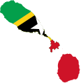
File:Flag-map of Saint Kitts and Nevis.svg
Appearance

Size of this PNG preview of this SVG file: 480 × 500 pixels. Other resolutions: 230 × 240 pixels | 461 × 480 pixels | 737 × 768 pixels | 983 × 1,024 pixels | 1,966 × 2,048 pixels.
Original file (SVG file, nominally 480 × 500 pixels, file size: 29 KB)
File history
Click on a date/time to view the file as it appeared at that time.
| Date/Time | Thumbnail | Dimensions | User | Comment | |
|---|---|---|---|---|---|
| current | 21:09, 12 December 2022 |  | 480 × 500 (29 KB) | Stasyan117 | Reverted to version as of 21:14, 3 February 2017 (UTC) |
| 16:51, 8 August 2022 |  | 810 × 839 (169 KB) | Fakenoodle | Reverted to version as of 17:43, 15 December 2020 (UTC) | |
| 16:48, 8 August 2022 |  | 480 × 500 (29 KB) | Fakenoodle | Reverted to version as of 21:14, 3 February 2017 (UTC), not sure why i reverted but svg wasnt working on that version | |
| 17:43, 15 December 2020 |  | 810 × 839 (169 KB) | Fakenoodle | Reverted to version as of 00:49, 10 December 2010 (UTC) | |
| 21:14, 3 February 2017 |  | 480 × 500 (29 KB) | Stasyan117 | reduce, the map in the middle of the flag does not affect the stars | |
| 00:49, 10 December 2010 |  | 810 × 839 (169 KB) | Fry1989 | reduce | |
| 21:44, 7 January 2010 |  | 806 × 841 (195 KB) | Darwinek | {{Information |Description=. |Source={{own}} |Date= |Author=Darwinek |Permission= |other_versions= }} |
File usage
The following 52 pages use this file:
- Basseterre Valley
- Bath, Saint Kitts and Nevis
- Black Rocks (Saint Kitts)
- Bloody Point
- Bloody River
- Boyds, Saint Kitts and Nevis
- Brick Kiln
- Butlers, Saint Kitts and Nevis
- Capisterre
- Cayon
- Challengers, Saint Kitts and Nevis
- Christ Church Nichola Town Parish
- Church Ground, Saint Kitts and Nevis
- Cotton Ground
- Dieppe Bay Town
- Dogwood Point
- Eden Brown Estate
- Figtree, Saint Kitts and Nevis
- Fort Charles (Nevis)
- Frigate Bay
- Great Salt Pond
- Independence Square (Basseterre)
- Mannings, Saint Kitts and Nevis
- Market Shop, Saint Kitts and Nevis
- Middle Island, Saint Kitts and Nevis
- Monkey Hill
- Newcastle, Saint Kitts and Nevis
- Newton Ground, Saint Kitts and Nevis
- Nichola Town
- North Friar's Bay
- Old Road Town
- Olivees Mountain
- Ottley's Village
- Palmetto Point
- Pinney's Beach
- Saddlers
- Saint Paul Capisterre
- Sandy Point Town
- South Friar's Bay
- Southeast Peninsula (Saint Kitts)
- St. Anthony's Peak
- Tabernacle, Saint Kitts and Nevis
- The Narrows (Saint Kitts and Nevis)
- Trinity, Saint Kitts and Nevis
- Vance W. Amory International Airport
- Verchild's Peak
- Zion, Saint Kitts and Nevis
- User:Alexp10801
- User:Dwscomet/My userbox creations
- User:Dwscomet/My userbox creations/KittitianAncestry
- Wikipedia:Userboxes/Life/Ancestry/02
- Template:SaintKittsNevis-geo-stub
Global file usage
The following other wikis use this file:
- Usage on ar.wikipedia.org
- Usage on ar.wikinews.org
- Usage on en.wikiversity.org
- Usage on es.wikipedia.org
- Usage on id.wikipedia.org
- Usage on it.wikipedia.org
- Usage on ko.wikipedia.org
- Usage on ms.wikipedia.org
- Usage on uk.wikipedia.org
- Usage on ur.wikipedia.org
View more global usage of this file.

