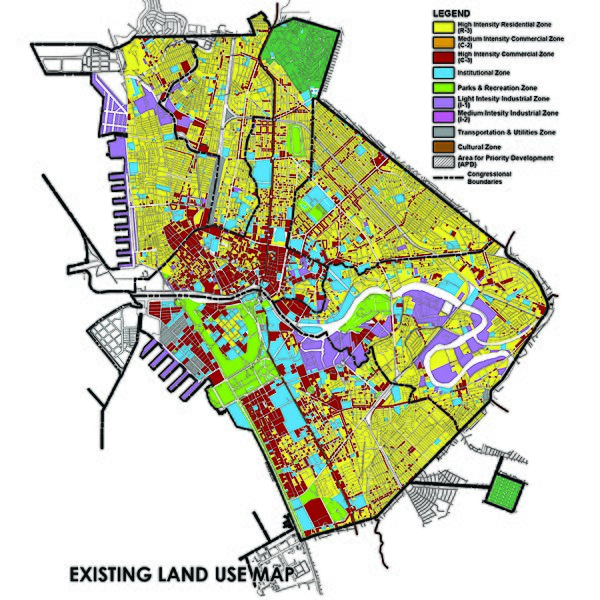
File:Existing Land Use Map of Manila 2017.jpg
Appearance

Size of this preview: 600 × 600 pixels. Other resolutions: 240 × 240 pixels | 480 × 480 pixels | 768 × 768 pixels | 1,024 × 1,024 pixels | 1,800 × 1,800 pixels.
Original file (1,800 × 1,800 pixels, file size: 3.69 MB, MIME type: image/jpeg)
| Description |
English: Existing Land Use Map of the City of Manila. | ||
|---|---|---|---|
| Source |
| ||
| Date | |||
| Author |
City Planning and Development Office | ||
| Permission (Reusing this file) |
Possible indication https://web.archive.org/web/20160304055726/http://emb.gov.ph/portal/Portals/21/News%20and%20Events/Public%20Hearing/Sec%202.1_land.pdf
|
File history
Click on a date/time to view the file as it appeared at that time.
| Date/Time | Thumbnail | Dimensions | User | Comment | |
|---|---|---|---|---|---|
| current | 16:28, 22 August 2017 |  | 1,800 × 1,800 (3.69 MB) | PH 0447 (talk | contribs) | {{Information |description={{en|1=Existing Land Use Map of the City of Manila.}} |date= |source= |author=City Planning and Development Office |permission= |other_versions= }} |
You cannot overwrite this file.
File usage
The following page uses this file:
