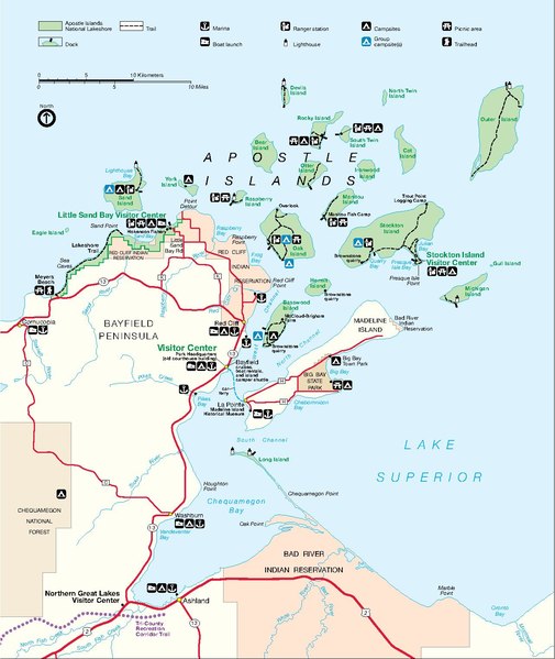
File:APISmap1.pdf
Appearance

Size of this JPG preview of this PDF file: 505 × 599 pixels. Other resolutions: 202 × 240 pixels | 405 × 480 pixels | 647 × 768 pixels | 863 × 1,024 pixels | 1,283 × 1,522 pixels.
Original file (1,283 × 1,522 pixels, file size: 118 KB, MIME type: application/pdf)
File history
Click on a date/time to view the file as it appeared at that time.
| Date/Time | Thumbnail | Dimensions | User | Comment | |
|---|---|---|---|---|---|
| current | 22:36, 15 November 2006 |  | 1,283 × 1,522 (118 KB) | Mashtato | {{Information |Description = Park map produced by the National Park Service of the Apostle Islands National Lakeshore, on the Wisconsion south shore of Lake Superior. Located in Bayfeild and Ashland Counties, Wisconsin. |Source = http://www.nps.gov/apis/p |
File usage
The following page uses this file:

