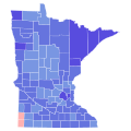
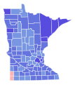
File:2012 United States Senate election in Minnesota results map by county.svg
Appearance

Size of this PNG preview of this SVG file: 600 × 600 pixels. Other resolutions: 240 × 240 pixels | 480 × 480 pixels | 768 × 768 pixels | 1,024 × 1,024 pixels | 2,048 × 2,048 pixels | 810 × 810 pixels.
Original file (SVG file, nominally 810 × 810 pixels, file size: 46 KB)
File history
Click on a date/time to view the file as it appeared at that time.
| Date/Time | Thumbnail | Dimensions | User | Comment | |
|---|---|---|---|---|---|
| current | 01:20, 13 February 2024 |  | 810 × 810 (46 KB) | Putitonamap98 | shapes |
| 00:55, 26 May 2021 |  | 744 × 744 (260 KB) | Petermgrund | Reverted to version as of 04:42, 15 May 2021 (UTC) | |
| 02:25, 16 May 2021 |  | 289 × 324 (1.08 MB) | TylerKutschbach | Reverted to version as of 23:46, 14 April 2021 (UTC) stop reverting these maps | |
| 04:42, 15 May 2021 |  | 744 × 744 (260 KB) | Elli | not unnecessary, this is for consistency across states and across maps. | |
| 23:46, 14 April 2021 |  | 289 × 324 (1.08 MB) | TylerKutschbach | Reverted to version as of 03:13, 10 April 2021 (UTC) | |
| 05:29, 14 April 2021 |  | 744 × 744 (260 KB) | Elli | new shapes with working thumbnail | |
| 03:13, 10 April 2021 |  | 289 × 324 (1.08 MB) | Petermgrund | Reverted to version as of 08:35, 3 February 2021 (UTC) broken file preview, plus no consensus on new shapes | |
| 05:18, 2 April 2021 |  | 744 × 744 (258 KB) | Awmcphee | Version with meaningful text IDs for counties | |
| 08:35, 3 February 2021 |  | 289 × 324 (1.08 MB) | AveryTheComrade | better shapes | |
| 18:18, 25 July 2018 |  | 512 × 574 (19 KB) | Kingofthedead | Reverted to version as of 02:23, 1 March 2018 (UTC) |
File usage
The following 3 pages use this file:

