Eye of the Sea (Warsaw)
Appearance
| Eye of the Sea | |
|---|---|
 The Eye of the Sea as seen from its southern coast, in 2020. | |
| Location | Eye of the Sea Park, Warsaw, Poland |
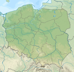
| Coordinates | 52°12′23″N 21°01′30″E / 52.206296°N 21.024865°E |
| Lake type | Artificial pond |
| Basin countries | |
| Surface area | 0.4358 hectares (1.077 acres) |
| Average depth | 2 metres (6 ft 7 in) |
| Surface elevation | 99.5 metres (326 ft) |
The Eye of the Sea (Polish: Morskie Oko) is an artificial pond in Warsaw, Poland, located within the district of Mokotów in the Eye of the Sea Park.
Characteristics
[edit]The Eye of the Sea is an artificial pond, located within the Eye of the Sea Park in the city of Warsaw, Poland.[1] It was formed in a flooded man-made clay pit. It is fed by the groundwater.[2] It has the total area of 0.4358 ha, and its between 1 and 2 m deep.[2][3] The lake is part of the drainage basin of the Czerniaków Cannal.[4] Its number in the catalogue of the Map of the Hydrographic Subdivision of Poland is 83337.[2]
References
[edit]- ^ Ewa Wolnicz-Pawłowska, Jerzy Duma, Janusz Rieger, Halina Czarnecka: Nazewnictwo geograficzne Polski. Tom 1. Hydronimy. Część 2. Wody stojące. Warsaw: General Office of the Geodesy and Cartography, 2006, p. 221. ISBN 83-239-9607-5. (in Polish)
- ^ a b c Zdzisław Biernacki: IV. Geomorfologia i wody powierzchniowe. In: Wisła w Warszawie. Warsaw: Spacial Planning and Architecture Division of the Warsaw Management Office, Dom Wydawniczy ELIPSA, 2000, p. 57. ISBN 83-907333-7-4. (in Polish)
- ^ Załącznik tekstwy i tablearyczny do Prograpmu Ochrony Środowiska dla miasta stołecznego Warszawa na lata 2009–2012 z uwzględnieniem perspektywy do 2016 r.. Warsaw: Warsaw City Council, 21 October 2010. (in Polish)
- ^ Ł. Szkudlarek: Analiza powierzchniowa zlewni. Charakterystyka i ocena funkcjonowania układu hydrograficznego, ze szczególnym uwzględnieniem systemów melioracyjnych na obszarze m.st. Warszawy wraz z zaleceniami do Studium uwarunkowań i kierunków zagospodarowania przestrzennego m.st. Warszawy i planów miejscowych. Warsaw: Warsaw City Hall, 2015, p. 20. (in Polish)

