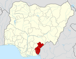
Etung
Appearance
Etung | |
|---|---|
 | |
| Country | |
| State | Cross River State |
| Government | |
| • Local Government Chairman | John Nkum Etuk |
| Time zone | UTC+1 (WAT) |
| Website | www |
 | |
Etung is a Local Government Area of Cross River State, Nigeria.[1] Its headquarters are in the town of Effraya.
It has an area of 815 km2 and a population of 80,196 at the 2006 census.
The postal code of the area is 551.[2]
Gallery
[edit]References
[edit]- ^ "Cross River State". Cross River Hub. Retrieved 2021-09-12.
- ^ "Post Offices- with map of LGA". NIPOST. Archived from the original on 2012-11-26. Retrieved 2009-10-25.


