Emanda
| Emanda | |
|---|---|
| Эмандьа | |
 Sentinel-2 image of the lake | |
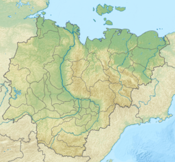
Location in the Sakha Republic, Russian Far East | |
| Location | Yana Plateau |
| Coordinates | 65°15′0″N 135°54′0″E / 65.25000°N 135.90000°E[1] |
| Primary outflows | Seen River |
| Catchment area | 179 km2 (69 sq mi) |
| Basin countries | Russia |
| Surface area | 33.1 km2 (12.8 sq mi) |
| Surface elevation | 678 m (2,224 ft) |
| Frozen | October to May |
Emanda (Russian: Еманда[2] or Эманджа,[3] Yakut: Эмандьа, Emanca) is a freshwater lake in Tomponsky District, Sakha Republic, Russia. The lake is located in a desolate area where there is no permanent population and few visitors. There are burbot, pike and grayling in its waters.
Geography
[edit]The lake lies at 678 m (2,224 ft) above mean sea level in the basin of the Derbeke River, part of the Yana basin.[3] It is located to the east of the river, roughly 50 km (31 mi) to the south of the Nelgesin Range. Lake Emanda is the largest lake of the Yana Plateau.[4]
The Seen River (Сеен), a right hand tributary of the Derbeke, is the outflow of the lake.[3]
The minimum temperature of -58.6 °C (-73.5 °F)[5] recorded on December 5, 2023 in Emanda, being the lowest December temperature in 40 years, according to weather historian Thierry Goose.[6]
 |
See also
[edit]References
[edit]- ^ Озеро Эманджа: Russia
- ^ "Ученые будут изучать озеро Еманда в Томпонском улусе Якутии". Archived from the original on 2020-01-24. Retrieved 2020-01-21.
- ^ a b c State Water Register- Озеро Эманджа (Иэма)
- ^ Google Earth
- ^ "24477: Iema (Russian Federation)". ogimet.com. OGIMET. 5 December 2023. Retrieved 11 December 2023.
- ^ Livingston, Ian (December 6, 2023). "Parts of Siberia are enduring extreme cold below minus-70 degrees". www.washingtonpost.com. The Washington Post. Retrieved December 11, 2023.
External links
[edit] Media related to Emanda at Wikimedia Commons
- озеро эманда на севере томпонского, летом туда можно ли добратся? (in Russian)
- Geographical places in Sakha (Yakutiya), Russia

