El Papalon Airport
Appearance
El Papalon Airport San Miguel Regional Airport | |||||||||||
|---|---|---|---|---|---|---|---|---|---|---|---|
| Summary | |||||||||||
| Airport type | Public | ||||||||||
| Serves | San Miguel | ||||||||||
| Elevation AMSL | 285 ft / 87 m | ||||||||||
| Coordinates | 13°26′40″N 88°07′40″W / 13.44444°N 88.12778°W | ||||||||||
| Map | |||||||||||
 | |||||||||||
| Runways | |||||||||||
| |||||||||||
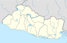
El Papalon Airport (ICAO: MSSM) is an airport serving the city of San Miguel in San Miguel Department, El Salvador. The runway is 5 kilometres (3.1 mi) southeast of the city, alongside the Pan American Highway.
The La Aramuaca Airport runway parallels the El Papalon runway, and is only 800 metres (2,600 ft) northeast.[3]
See also
[edit]References
[edit]- ^ Google Maps - El Papalon
- ^ Airport information for El Papalon Airport at Great Circle Mapper.
- ^ El Papalon and La Aramuaca
External links
[edit]

