El-Darad
El-Darad
Ceel Daraad | |
|---|---|
Sharmarke Ali Saleh's cannons deposited at El-Darad, El-Darad beach, El-Darad archaeological sites | |
| Coordinates: 10°45′40.9″N 45°34′42.6″E / 10.761361°N 45.578500°E | |
| Country | |
| Region | Sahil |
| District | Berbera District |
| Time zone | UTC+3 (EAT) |
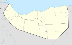
El-Darad (Somali: Ceel Daraad) was a historic coastal settlement and fort located in the Sahil region of Somaliland.
History
[edit]Legendary 15th century Arab explorer Ahmad ibn Mājid wrote of El-Darad and several other notable landmarks and ports of the northern Somali coast, including Berbera, the Sa'ad ad-Din islands (aka the Zeila Archipelago near Zeila), Alula, Ruguda, Maydh, Heis, Siyara and El-Sheikh.[1]
In the 19th century, El-Darad was a seasonal coastal trading settlement with a fort made of adobe (earth) and stone masonry, which was surrounded by Somali Aqal and Areesh (traditional nomadic and coastal dwellings respectively[2]). The fort was erected in circa 1826 and was owned by Muhammad Diban, a Habr Je'lo (Adan Madobe) pirate and slave trader based in El-Darad who garrisoned the fort with slaves armed with matchlock rifles.[3] Muhammad Diban also had cordial relations with Sharmarke Ali Saleh – governor and ruler of Zeila, Berbera and Tadjoura – who provided Muhammad with five cannons after Sharmarke lost control of Berbera in 1852.[4] The town today is inhabited by the Ahmed Farah Sub-division of the Habr Je'lo Clan family.
See also
[edit]- Administrative divisions of Somaliland
- Regions of Somaliland
- Districts of Somaliland
- Somalia–Somaliland border
References
[edit]- ^ "Ibn Majid". Medieval Science, Technology, and Medicine: An Encyclopedia. Routledge. 2005. ISBN 978-1-135-45932-1.
- ^ Drake-Brockman, Ralph Evelyn (1912). British Somaliland. Hurst & Blackett. p. 325.
- ^ Joint-Daguenet, Roger (1992). "Outre-MersRevue d'histoire" (La côte africaine du golfe d'Aden au milieu du XIXe siècle): 94.
{{cite journal}}: Cite journal requires|journal=(help) - ^ Burton. F., Richard (1856). First Footsteps in East Africa. pp. 436–437.
Note: The Author states that the fort was constructed around thirty years prior to when the book was published, which means the fort was probably completed in circa 1826.


