Eastern Charlotte
Eastern Charlotte | |
|---|---|
Rural community | |
 Magaguadavic River gorge and the St. George Power hydro plant | |
| Coordinates: 45°08′N 66°49′W / 45.133°N 66.817°W | |
| Country | Canada |
| Province | New Brunswick |
| County | Charlotte |
| Regional service commission | Southwest |
| Incorporated | January 1, 2023 |
| Government | |
| • Type | Rural community council |
| • Mayor | John D. Craig |
| Time zone | UTC-4 (AST) |
| • Summer (DST) | UTC-3 (ADT) |
| Postal code(s) | |
| Area code | 506 |
| Highways | |
Eastern Charlotte is a rural community in the Canadian province of New Brunswick. It was formed through the 2023 New Brunswick local governance reforms.
History
[edit]Eastern Charlotte was incorporated on January 1, 2023 via the amalgamation of the former town of St. George and the former village of Blacks Harbour as well as the concurrent annexation of adjacent unincorporated areas.[1]
Geography
[edit]
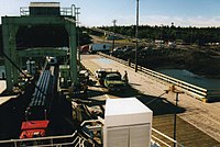
Eastern Charlotte is the northern terminus for the year-round Eastern Charlotte to Grand Manan Island Ferry operated by Coastal Transport
Fishing has been a vital part of its existence for over 200 years. Connors Brothers Limited was founded in 1885 at Blacks Harbour, now a major international processor of all types of seafood. The company is also a major New Brunswick employer.
See also
[edit]References
[edit]- ^ "Local Governments Establishment Regulation – Local Governance Act". Government of New Brunswick. August 30, 2022. Retrieved January 15, 2023.

