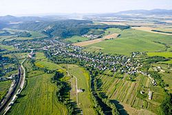
Družstevná pri Hornáde

Družstevná pri Hornáde is a village and municipality of the Košice-okolie District, located in the Kosice Region of eastern Slovakia.
Etymology
[edit]The name is derived from "Jednotné roľnícke družstvo", which was a type of agricultural cooperative that was common during the Soviet era.
History
[edit]Družstevná pri Hornáde was originally 3 villages: Malá Vieska, Kostoľany nad Hornádom and Tepličany. They were combined into one administrative area during the Soviet era. Kostoľany nad Hornádom became an independent municipality in 2003.
Geography
[edit]The village lies at an altitude of 258 metres and covers an area of 16.466 km². The municipality has a population of about 2,185 people. The River Hornád flows through the village.
Genealogical resources
[edit]The records for genealogical research are available at the state archive "Statny Archiv in Kosice, Slovakia"
See also
[edit]External links
[edit]48°48′18″N 21°14′50″E / 48.80500°N 21.24722°E
