Dray Sáp
Appearance
Dray Sáp | |
|---|---|
 A highland village in the commune of Dray Sáp. | |
| Coordinates: 12°7′16″N 108°32′38″E / 12.12111°N 108.54389°E | |
| Country | |
| Region | Central Highlands |
| Province | Đắk Lắk |
| District | Krông Ana District |
| Time zone | UTC+07:00 (Indochina Time) |
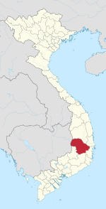
Dray Sáp is a commune (xã) in Krông Ana District, Đắk Lắk Province, Vietnam.
Economy
[edit]
An agricultural commune, it produces rice, coffee and pepper. The Buon Kuop hydropower plant in the commune has a capacity of 280MW. There are two waterfalls that flow through the commune, including the Gia Long and Dray Sap waterfalls which attract tourists.[1]
References
[edit]- ^ "Dray Sap and Gia Long Waterfalls". Frommer's. Retrieved June 19, 2010.


