Drake, Colorado
Appearance
Drake, Colorado | |
|---|---|
| Coordinates: 40°25′52.57″N 105°20′22.78″W / 40.4312694°N 105.3396611°W | |
| Country | |
| State | |
| County | Larimer County[1] |
| Elevation | 6,161 ft (1,878 m) |
| Time zone | UTC-7 (MST) |
| • Summer (DST) | UTC-6 (MDT) |
| ZIP code[2] | 80515 |
| Area code | 970 |
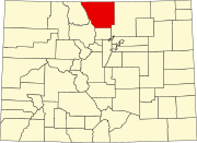
Drake is an unincorporated community in Larimer County, Colorado located in the Big Thompson Canyon between Estes Park, Colorado and Loveland, Colorado near Rocky Mountain National Park. A U.S. Post Office is also situated in the county ZIP Code 80515.[2] The 2010 population of Drake was 1,010.[3]
Geography
[edit]Its location is 40°25′52.57″N 105°20′22.78″W / 40.4312694°N 105.3396611°W (40.431269°, -105.339661°),[4] on U.S. Highway 34 along the Big Thompson River.
See also
[edit]References
[edit]- ^ a b "US Board on Geographic Names". United States Geological Survey. October 25, 2007. Retrieved January 31, 2008.
- ^ a b "ZIP Code Lookup". United States Postal Service. December 15, 2006. Archived from the original (JavaScript/HTML) on November 22, 2010. Retrieved December 15, 2006.
- ^ "ZIP Code 80515, Drake CO (Colorado)".
- ^ "US Gazetteer files: 2010, 2000, and 1990". United States Census Bureau. February 12, 2011. Retrieved April 23, 2011.


