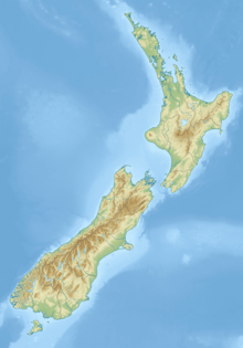
Douglas Peak (New Zealand)
Appearance
This article needs additional citations for verification. (June 2021) |
| Douglas Peak | |
|---|---|
| Highest point | |
| Elevation | 3,077 m (10,095 ft)[1] |
| Listing | New Zealand #7 |
| Coordinates | 43°32′30″S 170°12′09″E / 43.54167°S 170.20244°E[1] |
| Geography | |
| Location | South Island, New Zealand |
| Parent range | Southern Alps |
Douglas Peak is a 3,077 metres (10,095 ft) high mountain in the Southern Alps on the South Island of New Zealand. It is located few kilometres northeast of the second highest mountain of the country, the 3,497 metres (11,473 ft) high Mount Tasman. The mountain lies in between the Three-thousanders Mount Haidinger in the south and Glacier Peak northeast. To the west are tributary glaciers of the Fox Glacier, to the east tributaries of the Tasman Glacier.[1][2]
The mountain's peak forms part of the border between New Zealand's West Coast and Canterbury Regions.
References
[edit]- ^ a b c "Topographic map". NZTopoMap. Retrieved 31 May 2021.
- ^ "New Zealand Gazetteer". Retrieved 1 December 2022.

