Dos de Mayo Province
Appearance
Dos de Mayo | |
|---|---|
 Urqumayu valley | |
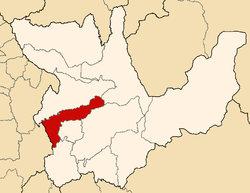
 Location of Dos de Mayo in the Huánuco Region | |
| Country | Peru |
| Region | Huánuco |
| Founded | November 5, 1870 |
| Capital | La Unión |
| Government | |
| • Mayor | Luis Maldonado Rivera (2019–2022) |
| Area | |
• Total | 1,438.88 km2 (555.55 sq mi) |
| Elevation | 3,226 m (10,584 ft) |
| Population | |
• Total | 33,258 |
| • Density | 23/km2 (60/sq mi) |
| UBIGEO | 1003 |
| Website | Official Website |
The Dos de Mayo Province (literally May 2) is one of eleven provinces of the Huánuco Region in Peru. The capital of this province is the city of La Unión.
Boundaries
[edit]- North: Huamalíes Province
- East: Leoncio Prado Province
- South: Huánuco Province, Yarowilca Province and Lauricocha Province
- West: Ancash Region
Geography
[edit]Some of the highest mountains of the province are listed below:[1]
- Allqa Raqra
- Allqay
- Aquy P'itiq
- Chuskuqucha
- Hanka Punta
- Hanka Wasi
- Hatun Punta
- Hatun P'unqu
- Hirka Kancha
- Kimsa Qucha
- Kinwa Qucha
- Kunkayuq
- Kushuru
- Khuchi Mach'ay
- Mama Hirka
- Maray
- Millpu Punta
- Pampa Wasi
- Pinqullu
- Pishtaq Punta
- Puchka Punta
- Puka Hirka
- Puka Raqra
- Phiruruyuq Punta
- P'itiq
- Qisqi Punta
- Qiwlla Qucha
- Quchayuq Punta
- Quriqucha
- Raqra Punta
- Riku Hirka
- Rumi Sunqu
- Rupha Pampa
- Saqra Waqra
- Saqsa Kusma
- Tikti Punta
- Tinku Pampa Punta
- Tuna Kancha
- Tutu Punta
- Ukru Wayin
- Waka Mach'ay Punta
- Wamalla Punta
- Wamash Punta
- Wank'a Mayu
- Wank'a Ukru Punta
- Wayta Hirka Punta
- Winchus
- Wiru Wiru
- Yana Mach'ay
- Yana Phaqcha
- Yuraq Yaku
- Yuraq Yaku Punta
Political division
[edit]The province is divided into nine districts, which are:
Ethnic groups
[edit]The province is inhabited by indigenous citizens of Quechua descent. Spanish, however, is the language which the majority of the population (59.82%) learnt to speak in childhood, 39.87% of the residents started speaking using the Quechua language (2007 Peru Census).[2]
See also
[edit]References
[edit]- ^ escale.minedu.gob.pe - UGEL map of the Dos de Mayo Province (Huánuco Region)
- ^ inei.gob.pe Archived January 27, 2013, at the Wayback Machine INEI, Peru, Censos Nacionales 2007
9°49′59″S 76°40′08″W / 9.833°S 76.669°W
