Dolní Cerekev
Dolní Cerekev | |
|---|---|
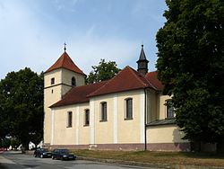
 Church of Saint Mary Magdalene | |
| Coordinates: 49°20′40″N 15°27′24″E / 49.34444°N 15.45667°E | |
| Country | |
| Region | Vysočina |
| District | Jihlava |
| First mentioned | 1352 |
| Area | |
| • Total | 15.85 km2 (6.12 sq mi) |
| Elevation | 528 m (1,732 ft) |
| Population (2024-01-01)[1] | |
| • Total | 1,232 |
| • Density | 78/km2 (200/sq mi) |
| Time zone | UTC+1 (CET) |
| • Summer (DST) | UTC+2 (CEST) |
| Postal codes | 588 45, 588 51 |
| Website | www |
Dolní Cerekev (Czech pronunciation: [ˈdolɲiː ˈtsɛrɛkɛf]; German: Unter Zerekwe) is a market town in Jihlava District in the Vysočina Region of the Czech Republic. It has about 1,200 inhabitants.
Administrative parts
[edit]The villages of Nový Svět and Spělov are administrative parts of Dolní Cerekev.
Etymology
[edit]The name Cerekev is derived from cierkev, which is an old Czech term for a wooden church. The attribute dolní ('lower') was added to distinguish it from Horní Cerekev ("Upper Cerekev").[2]
Geography
[edit]Dolní Cerekev is located about 10 kilometres (6 mi) southwest of Jihlava. It lies on the border between the Křemešník Highlands and Křižanov Highlands. The highest point is at 603 m (1,978 ft) above sea level. The Jihlava River flows through the market town.
History
[edit]The first written mention of Dolní Cerekev is from 1352. In 1451, the village was acquired by the Leskovec family. They had built here a fortress, which was first documented in 1552. From 1623 to 1918, Dolní Cerekev was owned by archbishopric of Prague.[3]
Demographics
[edit]
|
|
| ||||||||||||||||||||||||||||||||||||||||||||||||||||||
| Source: Censuses[4][5] | ||||||||||||||||||||||||||||||||||||||||||||||||||||||||
Transport
[edit]Dolní Cerekev is located on the main railway lines Brno–Plzeň and Jihlava–Tábor.[6]
Sights
[edit]The main landmark of Dolní Cerekev is the Church of Saint Mary Magdalene. It is a Neoclassical building with an early Gothic core from the 13th century and with a late Gothic tower.[7]
References
[edit]- ^ "Population of Municipalities – 1 January 2024". Czech Statistical Office. 2024-05-17.
- ^ Profous, Antonín (1947). Místní jména v Čechách I: A–H (in Czech). pp. 271–272.
- ^ "Program rozvoje městyse Dolní Cerekev na období let 2020–2025" (in Czech). Městys Dolní Cerekev. 2020-12-03. pp. 6–7. Retrieved 2023-09-07.
- ^ "Historický lexikon obcí České republiky 1869–2011" (in Czech). Czech Statistical Office. 2015-12-21.
- ^ "Population Census 2021: Population by sex". Public Database. Czech Statistical Office. 2021-03-27.
- ^ "Detail stanice Dolní Cerekev" (in Czech). České dráhy. Retrieved 2023-09-07.
- ^ "Kostel sv. Maří Magdalény s křížem" (in Czech). National Heritage Institute. Retrieved 2023-09-07.


