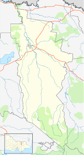
Docker, Victoria
| Docker Victoria | |
|---|---|
| Coordinates | 36°31′S 146°23′E / 36.517°S 146.383°E |
| Population | 120 (2016)[1] |
| Postcode(s) | 3678 |
| LGA(s) | Rural City of Wangaratta |
| State electorate(s) | Electoral district of Ovens Valley District |
| Federal division(s) | Division of Wangaratta Rural City Council |
Docker is a town in Victoria, Australia. It is located on Wangaratta-Whitfield Road along the King River. At the 2016 census, Docker recorded a population of 120.[1]
History
[edit]In 1838, the Docker family settled in nearby Bontharambo Plains.[2] It is likely the town of Docker is named after this family.
Traditional ownership
[edit]The formally recognised traditional owners for the northern area in which Docker sits are the Yorta Yorta people,[3] who are represented by the Yorta Yorta Nation Aboriginal Corporation.[4]
The formally recognised traditional owners for the southern area in which Docker sits are the Taungurung people.[3] The Taungurung People are represented by the Taungurung Land and waters Council Aboriginal Corporation.[5]
Demographics
[edit]As of the 2016 Australian census, 120 people resided in Docker. The median age of persons in Docker was 46 years. There were more males than females, with 51.3% of the population male and 48.7% female. The average household size was 2.7 people per household.[1]
78.4% of people in Docker were born in Australia. Nobody in Docker identified themselves as being Aboriginal and/or Torres Strait Islander people in the 2016 census. The most common ancestries in Docker were English 31.6%, Australian 27.1%, Scottish 11.6%, Irish 11.0% and Italian 7.1%.[1]
Industry
[edit]The industry that employs the most people in Docker is the beef cattle farming industry (13.0% of people employed aged over 15 years are in this industry), followed by dairy cattle farming (10.9%).[1]
Reference List
[edit]- ^ a b c d e Australian Bureau of Statistics (27 June 2017). "Docker (State Suburb)". 2016 Census QuickStats. Retrieved 2 June 2019.
- ^ "Heritage Citation Report" (PDF). Retrieved 2 June 2019.
- ^ a b "Map of formally recognised traditional owners". Aboriginal Victoria. Retrieved 2 June 2019.
- ^ "Gulpa gaka to Yorta Yorta Woka". Yorta Yorta Nation Aboriginal Corporation. Retrieved 2 June 2019.
- ^ "Taungurung Land and waters Council Aboriginal Corporation". Taungurung Land and waters Council Aboriginal Corporation. Retrieved 2 June 2019.


