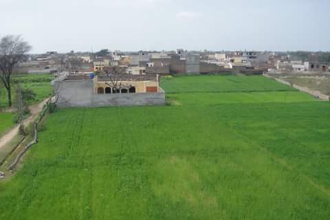
Dhool Khurd
Dhool Khurd (دھول خورد)/du:l hɔ:rd/ | |
|---|---|
Village | |
 | |
| Country | Pakistan |
| Province | Punjab |
| Division | Gujranwala |
| District | Gujrat District |
| Tehsil | Gujrat |
| Government | |
| Time zone | UTC+5 (PST) |
Dhool Khurd (دھول خورد) /du:l hɔ:rd/ is a village located in the Gujrat District of Punjab, Pakistan, situated approximately 6 km northeast of Gujrat city. Positioned along the Dinga-Gujrat road, it lies near the Bhimber creek, with the Lahore-Islamabad G.T road just 1 km away. The nomenclature of the village is derived from the Dhool clan of Jats, who coexist with various other clans, namely Jat Aaran, Jat Khokhar, Jat Virk, Jat Gondal, and a substantial number of non-agriculturalists.
Dhool Khurd is an integral part of the Aadowal union council and boasts a robust political history. Many individuals from this village have established themselves abroad, residing in countries like Saudi Arabia, UAE, UK, Europe, Canada, and Australia. They are engaged in diverse fields, including trade, construction, transport, real estate, and engineering. Notably, the village holds the distinction of having the highest count of employees working for WAPDA (Water and Power Development Authority).
The literacy rate in Dhool Khurd surpasses that of neighboring villages, and the population comprises around 4000 people distributed among over 300 families.


Aerial views of Dhool Khurd
[edit]Neighbouring villages
[edit]Schools
[edit]Government Boys Primary School Dhool Khurd
Government Girls Primary School Dhool Khurd
Government Girls High School Dhool Khurd


