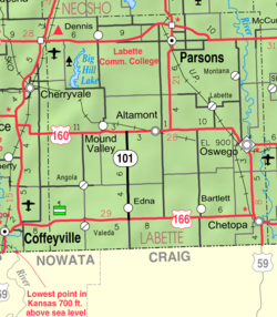
Dennis, Kansas
Appearance
Dennis, Kansas | |
|---|---|
 | |
| Coordinates: 37°20′49″N 95°24′46″W / 37.34694°N 95.41278°W[1] | |
| Country | United States |
| State | Kansas |
| County | Labette |
| Founded | 1880s |
| Elevation | 929 ft (283 m) |
| Population | |
| • Total | 152 |
| Time zone | UTC-6 (CST) |
| • Summer (DST) | UTC-5 (CDT) |
| Area code | 620 |
| FIPS code | 20-17675 [1] |
| GNIS ID | 2804492 [1] |
Dennis is a census-designated place (CDP) in Labette County, Kansas, United States.[1] As of the 2020 census, the population was 152.[2]
History
[edit]Dennis had its start in the early 1880s by the building of the Memphis, Kansas and Colorado Railroad through that territory.[3] The first post office in Dennis was established in May 1881.[4]
The nearby Big Hill Archeological District is on the National Register of Historic Places.
Demographics
[edit]| Census | Pop. | Note | %± |
|---|---|---|---|
| 2020 | 152 | — | |
| U.S. Decennial Census | |||
Education
[edit]The community is served by Labette County USD 506 public school district.
See also
[edit]References
[edit]- ^ a b c d e "Dennis, Kansas", Geographic Names Information System, United States Geological Survey, United States Department of the Interior
- ^ a b "Profile of Dennis, Kansas (CDP) in 2020". United States Census Bureau. Archived from the original on June 10, 2022. Retrieved June 10, 2022.
- ^ Blackmar, Frank Wilson (1912). Kansas: A Cyclopedia of State History, Embracing Events, Institutions, Industries, Counties, Cities, Towns, Prominent Persons, Etc. Standard Publishing Company. pp. 508.
- ^ "Kansas Post Offices, 1828-1961". Kansas Historical Society. Retrieved June 12, 2014.
Further reading
[edit]External links
[edit]


