Debeli Namet
Appearance
| Debeli Namet | |
|---|---|
| Location | Durmitor massif, Montenegro |
| Coordinates | 43°6′54″N 19°4′3″E / 43.11500°N 19.06750°E |
 | |
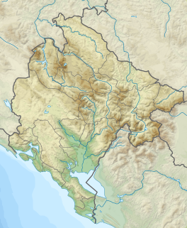
Debeli Namet is a small glacier below Mount Šljeme (2,455 metres (8,054 ft)) in the Durmitor massif, Montenegro.
Geography
[edit]This glacier exists well below the true snowline and is sustained by avalanching snow. Results of recent investigations on the Debeli Namet glacier have been published by a British scientist (Hughes 2007). The Debeli Namet glacier is not quite the southernmost glacier in Europe, as this status currently goes to the Snezhnika glacier (latitude of 41°46′09″ N)[1] followed by Banski Suhodol Glacier[2] also in Pirin mountain in Bulgaria and the Calderone Glacier in Italy.[3]
References
[edit]- ^ Grunewald, K; Scheithauer, J (2010), "Europe's southernmost glaciers: response and adaptation to climate change", Journal of Glaciology, 56 (195): 129–142, Bibcode:2010JGlac..56..129G, doi:10.3189/002214310791190947
- ^ Emil Gachev, Alexander Gikov, Cvetelina Zlatinova, Bozidar Blagoev Present state of Bulgarian glacierets Landform Analysis, Vol. 11: 16–24 ISSN 2081-5980
- ^ Hughes, P.D. (2007) Recent behaviour of the Debeli Namet glacier, Durmitor, Montenegro. Earth Surface Processes and Landforms, 32, 1593-1602.


