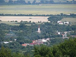
Davidov (municipality)
Appearance
This article needs additional citations for verification. (February 2013) |
Davidov | |
|---|---|
Municipality | |
 | |
Location of Davidov in the Prešov Region | |
| Coordinates: 48°50′N 21°38′E / 48.833°N 21.633°E | |
| Country | |
| Region | Prešov |
| District | Vranov nad Topľou |
| First mentioned | 1361 |
| Area | |
• Total | 16.79 km2 (6.48 sq mi) |
| Elevation | 197 m (646 ft) |
| Population | |
• Total | 794 |
| • Density | 47/km2 (120/sq mi) |
| Time zone | UTC+1 (CET) |
| • Summer (DST) | UTC+2 (CEST) |
| Postal code | 093 03 (pošta Vranov nad Topľou 3) |
| Area code | +421-57 |
| Car plate | VT |
| Website | www |
Davidov (Hungarian: Dávidvágása) is a village and municipality in the Vranov nad Topľou District in the Prešov Region of Slovakia.
Population
[edit]According to the 2011 census, the municipality had 794 inhabitants. 784 of inhabitants were Slovaks and 10 others and unspecified.[1]
See also
[edit]References
[edit]- ^ "Archived copy" (PDF). Archived from the original (PDF) on 2012-11-14. Retrieved 2012-08-10.
{{cite web}}: CS1 maint: archived copy as title (link)
Genealogical resources
[edit]The records for genealogical research are available at the state archive "Statny Archiv in Presov, Slovakia"
- Roman Catholic church records (births/marriages/deaths): 1770-1895 (parish B)
- Greek Catholic church records (births/marriages/deaths): 1780-1933 (parish A)
External links
[edit] Media related to Davidov at Wikimedia Commons
- Official website

- Country data
- Surnames of living people in Davidov


