Crowfields Common
Appearance
| Crowfields Common | |
|---|---|
 | |
 | |
| Type | Local Nature Reserve |
| Location | Moulton, Northamptonshire |
| OS grid | SP 787 659 |
| Area | 8.7 hectares |
| Managed by | Moulton Parish Council |
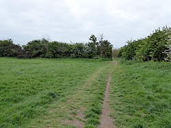
Crowfields Common is an 8.7 hectare Local Nature Reserve in Moulton in Northamptonshire. It is owned and managed by Moulton Parish Council.[1][2]
The site is grassland which has surviving medieval ridge and furrow. There are also mature trees and hedgerows, and a flower meadow.[1]
There is access from Dove's Lane.
Wikimedia Commons has media related to Crowfields Common.
References
[edit]- ^ a b "Crowfields Common". Local Nature Reserves. Natural England. 25 March 2013. Archived from the original on 21 December 2016. Retrieved 30 April 2017.
- ^ "Map of Crowfields Common". Local Nature Reserves. Natural England. Retrieved 30 April 2017.
