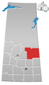
Crooked River, Saskatchewan
Appearance
Crooked River is a special service area in the Canadian province of Saskatchewan.[1] It is on the banks of Crooked River[2] and access is from Highway 23.
Demographics
[edit]In the 2021 Census of Population conducted by Statistics Canada, Crooked River had a population of 49 living in 20 of its 25 total private dwellings, a change of 53.1% from its 2016 population of 32. With a land area of 0.28 km2 (0.11 sq mi), it had a population density of 175.0/km2 (453.2/sq mi) in 2021.[3]
See also
[edit]References
[edit]- ^ "Municipal Directory System" (PDF). Government of Saskatchewan. p. 226. Retrieved 19 November 2016.[permanent dead link]
- ^ "Crooked River". Canadian Geographical Names Database. Government of Canada. Retrieved 16 September 2024.
- ^ "Population and dwelling counts: Canada and designated places". Statistics Canada. 9 February 2022. Retrieved 31 August 2022.
52°51′00″N 103°44′02″W / 52.85000°N 103.73389°W

