Coxs Bay
| Opoututeka / Coxs Bay | |
|---|---|
 Opoututeka (Coxs Bay), Auckland, NZ | |
| Location | Waitematā Harbour |
| Coordinates | 36°51′00″S 174°43′30″E / 36.849917°S 174.725041°E |
| River sources | Coxs Creek |
| Basin countries | New Zealand |
| Max. length | 1 km (0.62 mi) |
| Max. width | 1 km (0.62 mi) |
| Surface area | 1 km2 (0.39 sq mi) |
| Average depth | .2 metres (0.66 ft) |
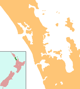
Coxs Bay or Opoututeka is a bay located in the Waitematā Harbour, within the Auckland region of New Zealand. It is situated between the settlements of Westmere to the southwest and Herne Bay to the northeast, with Grey Lynn to the southeast. The bay is protected from the west by Te Tokoroa/Meola Reef, the end of one of the longest lava flows in the Auckland volcanic field.[1][2]
History
[edit]The bay, creek and surrounding land, with its extensive wetlands, food sources and flax, held significant importance for multiple iwi.[3] Flax grown in the Coxs Bay gully was harvested, processed, and then dried on the north-facing hills in Herne Bay.[3]
The first European land purchase in the area around Coxs Bay occurred in 1840.[4] The western boundary of this land was marked by Opou or Coxs Creek. In the early 1840s, John and Jane Cox established a market garden in the area, from which the European name for the Creek and Bay originated.[3][4][5]
In 1859, the area then known as Richmond, situated between Edgars and Coxs Creek, was subdivided into lots.[6] The streets now known as Regina, Kingsley, Livingstone, Webber, and Edgars (formerly Queen, King, Stanley, Webber, and Victoria) were laid out, and logs for the early houses were floated up Coxs Creek and pit-sawn on site.[6][7]


Industrial development in the area began with a brick factory in 1860, with products being shipped via Coxs Creek to Auckland. In 1899, Cashmore Brothers established a steam-powered sawmill beside the creek below Coxs Bridge Rd (later renamed West End Rd).[8] The bay and creek were used for the transport of logs and timber. Despite strong protests from the growing local population, the mill operated until 1920, when it accidentally burnt down, leaving sawdust and timber smoldering for over a year.[8][9]
The bridge over Coxs Creek, connecting Westmere and Herne Bay, was first recorded in 1881, then demolished in 1885 and rebuilt in 1886.[10][11][12] The lower level of the Hawke Scout Hall, built in the late 1920s, remains an important part of the local community and a significant building in the area.
In 1938, a landslide deposited several tons of earth onto the road and Coxs Creek bridge.[13] In January 2023, extensive flooding caused several landslides and a fallen tree, leading to the closure of West End Road.[14]
Present Day
[edit]Across West End Road from the Bay is Coxs Bay Reserve, a large park with sports fields for rugby and cricket.[15] It is approximately 14 hectares, and there are several walking trails through the park.[15]
Coxs Bay itself is considered unsuitable for swimming, collecting shellfish, and fishing due to poor water quality, and this is a special status due to either "a history of poor or highly variable water quality".[16] It is a permanent no-swim notice, due to frequent wastewater spills.[17] In 2007, Auckland City Council dredged the Creek to restore tidal flow and in 2013, Watercare Services Limited announced a $1 billion dollar project to intercept major overflows, that would make the Bay and Creek swimmable again.[18] This project is scheduled to be completed in 2030.[18]
References
[edit]- ^ McClure, Margaret (6 December 2007). "Meola reef". 'Auckland places - Waitematā Harbour', Te Ara - the Encyclopedia of New Zealand. Archived from the original on 12 August 2022.
- ^ McClure, Margaret (6 December 2007). "Waitematā Harbour". 'Auckland places - Waitematā Harbour', Te Ara - the Encyclopedia of New Zealand. Archived from the original on 26 October 2022.
- ^ a b c "Get to know Westmere". Ray White Ponsonby. 14 October 2022. Retrieved 15 June 2023.
- ^ a b Sturm, Sean (14 March 2010). "Meanderings about Cox's Creek". TE IPU PAKORE: THE BROKEN VESSEL. Archived from the original on 22 September 2016.
- ^ Hiyama, Kaaren (1991). High hopes in hard times : a history of Grey Lynn and Westmere. Grey Lynn, N.Z.: Media Studies Trust. p. 10. ISBN 0-473-01467-X. OCLC 154684723.
- ^ a b Hiyama, Kaaren (1991). High hopes in hard times : a history of Grey Lynn and Westmere. Grey Lynn, N.Z.: Media Studies Trust. p. 11. ISBN 0-473-01467-X. OCLC 154684723.
- ^ "Advertisements Column 2". New Zealand Herald. Vol. LIV, no. 16473. 24 February 1917. p. 10.
- ^ a b Hiyama, Kaaren (1991). High hopes in hard times : a history of Grey Lynn and Westmere. Media Studies Trust. Grey Lynn, N.Z.: Media Studies Trust. pp. 45–46. OCLC 154684723.
- ^ "TIMBER MILL BURNED". New Zealand Herald. Vol. LVII, no. 17361. 7 January 1920. p. 6.
- ^ "Untitled". New Zealand Herald. Vol. XIX, no. 6417. 12 June 1882. p. 4.
- ^ "SCINTILLATIONS". Auckland Star. Vol. XII, no. 3394. 16 June 1881. p. 2.
- ^ "City Council". New Zealand Herald. Vol. XXII, no. 7281. 20 March 1885. p. 6.
- ^ "NORTHERN ROADS". New Zealand Herald. Vol. LXXV, no. 23100. 27 July 1938. p. 14.
- ^ "'It was pretty crazy': Tree collapses on Herne Bay Rd". NZ Herald. 16 June 2023. Retrieved 15 June 2023.
- ^ a b Council, Auckland. "Coxs Bay Reserve". Auckland Council. Retrieved 15 June 2023.
- ^ "Cox's Bay". Land, Air, Water Aotearoa (LAWA). Retrieved 15 June 2023.
- ^ "The invisible contamination at New Zealand's beaches". Newshub. Retrieved 15 June 2023.
- ^ a b Owen, Catrin (16 November 2016). "Auckland bay's swimming in sewage and tampons". Stuff. Retrieved 15 June 2023.

