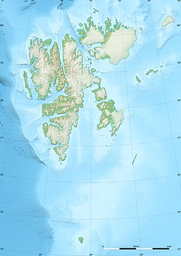
Comfortlessbreen
Appearance
| Comfortlessbreen | |
|---|---|
 | |
| Type | Glacier |
| Location | Oscar II Land Spitsbergen, Svalbard |
| Coordinates | 78°46′N 12°08′E / 78.76°N 12.14°E |
| Length | 14 km |
| Width | 3 km |
| Terminus | Engelskbukta |
Comfortlessbreen is a glacier in Oscar II Land at Spitsbergen, Svalbard. It has a length of about fourteen kilometers, and a maximum width of three kilometers. The glacier debouches into Engelskbukta, after a merge with Uvêrsbreen.[1][2][3] Comfortlessbreen is separated from Uvêrsbreen by the mountain range of Trondheimfjella (with Domkyrkja in the west).[4]
References
[edit]- ^ "Comfortlessbreen (Svalbard)". Norwegian Polar Institute. Retrieved 6 November 2013.
- ^ "Uvêrsbreen (Svalbard)". Norwegian Polar Institute. Retrieved 6 November 2013.
- ^ Arctic Pilot: Sailing directions Svalbard–Jan Mayen. Vol. 7. Stavanger: The Norwegian Hydrographic Service and The Norwegian Polar Institute. 1988. p. 245. ISBN 82-90653-06-9.
- ^ "Domkyrkja (Svalbard)". Norwegian Polar Institute. Retrieved 6 November 2013.
Wikimedia Commons has media related to Comfortlessbreen.

