Circleville, West Virginia
Appearance
Circleville | |
|---|---|
| Coordinates: 38°40′15″N 79°29′28″W / 38.67083°N 79.49111°W | |
| Country | United States |
| State | West Virginia |
| County | Pendleton |
| Elevation | 2,057 ft (627 m) |
| Time zone | UTC-5 (Eastern (EST)) |
| • Summer (DST) | UTC-4 (EDT) |
| ZIP code | 26804[1] |
| GNIS feature ID | 1554138[2] |
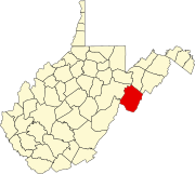
Circleville is an unincorporated community located in Pendleton County, West Virginia, United States.[2] Circleville was originally named Zirkleville after John Zirkle, who ran a dry goods store in the town.[3][4] The old Circleville School is listed on the National Register of Historic Places.[5]
Circleville is located on West Virginia Route 28 along the North Fork of South Branch of the Potomac River at its confluence with Pike Gap and Bouses Runs.
In literature
[edit]In his 2001 book At Home in the Heart of Appalachia, John O'Brien refers to Circleville as a "lonely outpost in the ice-cold mountains."[4]
References
[edit]- ^ "Circleville ZIP Code". zipdatamaps.com. 2022. Retrieved November 30, 2022.
- ^ a b "Circleville". Geographic Names Information System. United States Geological Survey, United States Department of the Interior.
- ^ Kenny, Hamill (1945). West Virginia Place Names: Their Origin and Meaning, Including the Nomenclature of the Streams and Mountains. Piedmont, WV: The Place Name Press. p. 172.
- ^ a b O'Brien, John (2002). At Home in the Heart of Appalachia (2nd ed.). Anchor. p. 167.
- ^ "National Register Information System". National Register of Historic Places. National Park Service. July 9, 2010.
Wikimedia Commons has media related to Circleville, West Virginia.


