Chicche District
Appearance
Chicche | |
|---|---|
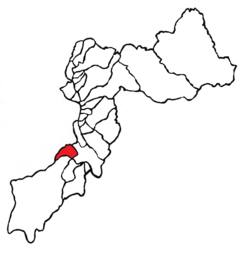
 Location of the district in the province of Huancayo, department of Junín, Peru | |
 | |
| Country | |
| Region | Junín |
| Province | Huancayo |
| Founded | December 2, 1961 |
| Capital | Chicche |
| Government | |
| • Mayor | Ruben Meza Bonifacio |
| Area | |
• Total | 43.43 km2 (16.77 sq mi) |
| Elevation | 3,540 m (11,610 ft) |
| Population | |
• Total | 1,378 |
| • Density | 32/km2 (82/sq mi) |
| Time zone | UTC-5 (PET) |
| UBIGEO | 120106 |
Chicche District is one of twenty-eight districts of the province Huancayo in Peru.[1]
References
[edit]- ^ (in Spanish) Instituto Nacional de Estadística e Informática. Banco de Información Distrital Archived April 23, 2008, at the Wayback Machine. Retrieved April 11, 2008.
