Cheeverstown Luas stop
Appearance
 Cheeverstown Luas stop, Cheeverstown Road | |||||||||||
| General information | |||||||||||
| Location | Dublin Ireland | ||||||||||
| Coordinates | 53°17′28″N 6°24′25″W / 53.290991607006696°N 6.406856477637703°W | ||||||||||
| Owned by | Transport Infrastructure Ireland | ||||||||||
| Operated by | Luas | ||||||||||
| Line(s) | Red | ||||||||||
| Platforms | 2 | ||||||||||
| Bus routes | 1 | ||||||||||
| Bus stands | 1 | ||||||||||
| Bus operators | Go-Ahead Ireland | ||||||||||
| Connections | W4 | ||||||||||
| Construction | |||||||||||
| Structure type | At-grade | ||||||||||
| Other information | |||||||||||
| Fare zone | Red 4 | ||||||||||
| Key dates | |||||||||||
| 2 July 2011 | Station opened | ||||||||||
| Services | |||||||||||
| |||||||||||
| |||||||||||
| ||||||||||||||||||||||||||||||||||||||||||||||||||||||||||||||||||||||||||||||||||||||||||||||||||||||||||||||||||||||||||||||||||||||||||||||||||||||||||||||||||||||||||||||||||||||||||||||||||||||||||||||||||||||||||||||||||||||||||||||||||||||||||||||||||||||||||||||||||||||||||||||||||||||||||||
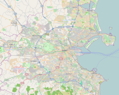
Cheeverstown (Irish: Baile an tSíbhrigh) is a stop on the Luas light-rail tram system in Dublin, Ireland. It opened in 2011 as a stop on the extension of the Red Line to Saggart.[1] The stop is located on a section of reserved track at the side of Katherine Tynan Road in the Cheeverstown area of south-west Dublin.[2] The stop has a park and ride facility with 312 spaces.[3]
References
[edit]- ^ "Minister opens Luas Red Line branch to Citywest and Saggart". The Irish Times.
- ^ "Cheeverstown". Luas.
- ^ "Cheeverstown P+R". Luas.

