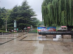
Changle County
Appearance
Changle County
昌乐县 | |
|---|---|
 | |
| Coordinates: 36°42′N 118°45′E / 36.700°N 118.750°E | |
| Country | People's Republic of China |
| Province | Shandong |
| Prefecture-level city | Weifang |
| Area | |
| • Total | 1,101 km2 (425 sq mi) |
| Population (2018) | |
| • Total | 638,000 |
| • Density | 580/km2 (1,500/sq mi) |
| Time zone | UTC+8 (China Standard) |
| Postal code | 262400 |
Changle County (simplified Chinese: 昌乐县; traditional Chinese: 昌樂縣; pinyin: Chānglè Xiàn) is under the administration of Weifang, in Shandong Province. The ancient Kingdom of Beihai was located to the west of present-day Changle County.
Administrative divisions
[edit]As 2017, this county is divided to 5 subdistricts and 4 towns.[1]
- Subdistricts
|
|
- Towns
|
|
Climate
[edit]| Climate data for Changle (1991–2020 normals, extremes 1981–2010) | |||||||||||||
|---|---|---|---|---|---|---|---|---|---|---|---|---|---|
| Month | Jan | Feb | Mar | Apr | May | Jun | Jul | Aug | Sep | Oct | Nov | Dec | Year |
| Record high °C (°F) | 18.6 (65.5) |
23.1 (73.6) |
32.3 (90.1) |
34.4 (93.9) |
40.2 (104.4) |
40.9 (105.6) |
39.7 (103.5) |
38.0 (100.4) |
38.5 (101.3) |
32.9 (91.2) |
26.2 (79.2) |
22.6 (72.7) |
40.9 (105.6) |
| Mean daily maximum °C (°F) | 3.5 (38.3) |
7.3 (45.1) |
14.0 (57.2) |
21.0 (69.8) |
26.5 (79.7) |
30.5 (86.9) |
31.5 (88.7) |
30.2 (86.4) |
26.9 (80.4) |
20.9 (69.6) |
12.8 (55.0) |
5.5 (41.9) |
19.2 (66.6) |
| Daily mean °C (°F) | −2.3 (27.9) |
1.1 (34.0) |
7.4 (45.3) |
14.4 (57.9) |
20.2 (68.4) |
24.5 (76.1) |
26.5 (79.7) |
25.3 (77.5) |
21.0 (69.8) |
14.4 (57.9) |
6.7 (44.1) |
−0.2 (31.6) |
13.3 (55.9) |
| Mean daily minimum °C (°F) | −6.7 (19.9) |
−3.9 (25.0) |
1.4 (34.5) |
8.0 (46.4) |
13.7 (56.7) |
18.8 (65.8) |
22.1 (71.8) |
21.3 (70.3) |
15.9 (60.6) |
8.9 (48.0) |
1.7 (35.1) |
−4.6 (23.7) |
8.1 (46.5) |
| Record low °C (°F) | −19.7 (−3.5) |
−17.5 (0.5) |
−11.0 (12.2) |
−4.0 (24.8) |
0.1 (32.2) |
7.5 (45.5) |
13.1 (55.6) |
11.9 (53.4) |
3.9 (39.0) |
−3.2 (26.2) |
−12.2 (10.0) |
−24.2 (−11.6) |
−24.2 (−11.6) |
| Average precipitation mm (inches) | 8.9 (0.35) |
13.2 (0.52) |
11.3 (0.44) |
30.4 (1.20) |
55.1 (2.17) |
70.4 (2.77) |
145.4 (5.72) |
175.7 (6.92) |
54.5 (2.15) |
29.2 (1.15) |
28.6 (1.13) |
11.4 (0.45) |
634.1 (24.97) |
| Average precipitation days (≥ 0.1 mm) | 3.1 | 3.7 | 3.4 | 5.1 | 7.0 | 8.6 | 12.0 | 11.7 | 7.0 | 5.1 | 4.8 | 4.0 | 75.5 |
| Average snowy days | 4.1 | 3.3 | 1.6 | 0.2 | 0 | 0 | 0 | 0 | 0 | 0 | 1.4 | 2.6 | 13.2 |
| Average relative humidity (%) | 62 | 59 | 51 | 52 | 59 | 64 | 77 | 81 | 75 | 68 | 66 | 63 | 65 |
| Mean monthly sunshine hours | 165.3 | 169.5 | 221.2 | 241.3 | 260.6 | 224.2 | 195.0 | 186.7 | 192.7 | 194.9 | 167.6 | 165.9 | 2,384.9 |
| Percent possible sunshine | 53 | 55 | 59 | 61 | 59 | 51 | 44 | 45 | 52 | 57 | 55 | 56 | 54 |
| Source: China Meteorological Administration[2][3] | |||||||||||||
References
[edit]- ^ 2017年统计用区划代码和城乡划分代码:昌乐县 (in Chinese). National Bureau of Statistics of the People's Republic of China. 2017. Retrieved 2018-11-16.
统计用区划代码 名称 370725001000 宝都街道办事处 370725002000 宝城街道办事处 370725003000 朱刘街道办事处 370725005000 五图街道办事处 370725107000 乔官镇 370725108000 唐吾镇 370725110000 红河镇 370725116000 营丘镇
- ^ 中国气象数据网 – WeatherBk Data (in Simplified Chinese). China Meteorological Administration. Retrieved 12 August 2023.
- ^ 中国气象数据网 (in Simplified Chinese). China Meteorological Administration. Retrieved 12 August 2023.
- Luo, Guanzhong. Annotated Romance of the Three Kingdoms/Chapter 5, page 69, note 10 (in Chinese). ISBN 957-9113-05-X.

