Chandauli Majhwar railway station
Appearance
(Redirected from Chandauli Majhwar)
Chandauli Majhwar | |||||||||||
|---|---|---|---|---|---|---|---|---|---|---|---|
| Indian Railways station | |||||||||||
 | |||||||||||
| General information | |||||||||||
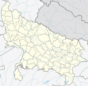
| Location | National Highway 2, Chandauli, Uttar Pradesh India | ||||||||||
| Coordinates | 25°15′41″N 83°16′04″E / 25.2613°N 83.2679°E | ||||||||||
| Elevation | 80 metres (260 ft) | ||||||||||
| Owned by | Indian Railways | ||||||||||
| Operated by | East Central Railway | ||||||||||
| Line(s) | Gaya–Pandit Deen Dayal Upadhyaya Junction section Howrah–Gaya–Delhi line Grand Chord Howrah–Prayagraj–Mumbai line | ||||||||||
| Platforms | 5 | ||||||||||
| Construction | |||||||||||
| Structure type | Standard on ground | ||||||||||
| Parking | No | ||||||||||
| Bicycle facilities | No | ||||||||||
| Other information | |||||||||||
| Status | Functioning | ||||||||||
| Station code | CDMR | ||||||||||
| Division(s) | Pandit Deen Dayal Upadhyaya | ||||||||||
| History | |||||||||||
| Opened | 1906 | ||||||||||
| Electrified | 1961–63 | ||||||||||
| Services | |||||||||||
| |||||||||||
| |||||||||||
Chandauli Majhwar railway station is on the Delhi–Howrah line. It is located in Chandauli district in the Indian state of Uttar Pradesh. It serves Chandauli and the surrounding areas. Its name is derived from the district name Chandauli and nearby village named Majhwar Khas.
History
[edit]The East Indian Railway Company started connecting Delhi and Howrah from the mid nineteenth century. In 1862, the railway tracks crossed Mughalsarai and reached the western bank of the Yamuna. The through link to Delhi was established in 1866.[1] The Grand Chord was commissioned in 1906.[2]
Electrification
[edit]The Mughalsarai–Howrah sector was electrified in 1961–63.[3]
References
[edit]- ^ "IR History: Early History (1832–1869)". IRFCA. Retrieved 19 June 2013.
- ^ "IR History: Part III (1900–1947)". IRFCA. Retrieved 19 June 2013.
- ^ "History of Electrification". IRFCA. Retrieved 19 June 2013.
External links
[edit]

