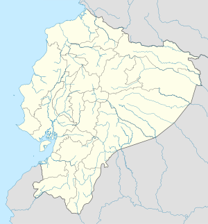
Chalpi
Appearance
This article needs additional citations for verification. (February 2020) |
Chalpi | |
|---|---|
| Coordinates: 0°22′31.27″S 78°4′39.58″W / 0.3753528°S 78.0776611°W | |
| Country | |
| Province | Napo |
| Canton | Quijos |
| Elevation | 3,052 m (10,013 ft) |
| Time zone | UTC-5 (Ecuador Time) |
Chalpi is a village in Quijos canton, Napo Province in Ecuador.
Climate
[edit]Chalpi has a Subtropical highland climate (Cfb) with cool weather year-round and moderately heavy rainfall.
| Climate data for Chalpi | |||||||||||||
|---|---|---|---|---|---|---|---|---|---|---|---|---|---|
| Month | Jan | Feb | Mar | Apr | May | Jun | Jul | Aug | Sep | Oct | Nov | Dec | Year |
| Mean daily maximum °C (°F) | 16.4 (61.5) |
16.2 (61.2) |
15.8 (60.4) |
16.0 (60.8) |
15.7 (60.3) |
14.7 (58.5) |
14.4 (57.9) |
14.8 (58.6) |
15.5 (59.9) |
16.5 (61.7) |
17.0 (62.6) |
16.6 (61.9) |
15.8 (60.4) |
| Daily mean °C (°F) | 11.1 (52.0) |
11.1 (52.0) |
11.1 (52.0) |
11.3 (52.3) |
11.1 (52.0) |
10.4 (50.7) |
10.1 (50.2) |
10.3 (50.5) |
10.7 (51.3) |
11.2 (52.2) |
11.6 (52.9) |
11.2 (52.2) |
10.9 (51.7) |
| Mean daily minimum °C (°F) | 5.9 (42.6) |
6.1 (43.0) |
6.5 (43.7) |
6.7 (44.1) |
6.6 (43.9) |
6.1 (43.0) |
5.9 (42.6) |
5.8 (42.4) |
5.9 (42.6) |
6.0 (42.8) |
6.2 (43.2) |
5.9 (42.6) |
6.1 (43.0) |
| Average precipitation mm (inches) | 103 (4.1) |
86 (3.4) |
106 (4.2) |
119 (4.7) |
131 (5.2) |
123 (4.8) |
126 (5.0) |
107 (4.2) |
107 (4.2) |
104 (4.1) |
94 (3.7) |
81 (3.2) |
1,287 (50.8) |
| Source: Climate-Data.org[1] | |||||||||||||
References
[edit]- ^ "Climate: Chalpi". Climate-Data.org. Retrieved January 1, 2020.

