Chýně
Chýně | |
|---|---|
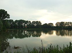
 Bašta Pond | |
| Coordinates: 50°3′39″N 14°13′37″E / 50.06083°N 14.22694°E | |
| Country | |
| Region | Central Bohemian |
| District | Prague-West |
| First mentioned | 1273 |
| Government | |
| • Mayor | Anna Chvojková |
| Area | |
| • Total | 5.00 km2 (1.93 sq mi) |
| Elevation | 370 m (1,210 ft) |
| Population (2024-01-01)[1] | |
| • Total | 4,817 |
| • Density | 960/km2 (2,500/sq mi) |
| Time zone | UTC+1 (CET) |
| • Summer (DST) | UTC+2 (CEST) |
| Postal code | 253 03 |
| Website | www |
Chýně is a town in Prague-West District in the Central Bohemian Region of the Czech Republic. It has about 4,800 inhabitants. The town is a suburb of Prague.
Etymology
[edit]The initial name of the settlement was probably Chajín. The name was derived from the personal name Chája, meaning "Chája's (court)". The name was gradually distorted to Chajn and then to Chejn. From the 19th century, the name Chýně is used.[2]
Geography
[edit]Chýně is located about 5 kilometres (3 mi) west of Prague. It lies in an agricultural landscape of the Prague Plateau.
The stream Litovický potok runs east along the northern border and supplies two small fishponds. The upper pond is called Bašta and is used for recreational purposes. The lower pond is called Strahovský.
History
[edit]The area of the town has been inhabited since prehistoric times. Iron furnaces that were found here are the oldest examples known in Bohemia and Moravia. The first written mention of Chýně is from 1273.[3]
The village used to belong to Strahov Monastery and until recently it was a small farming community. Proximity to Prague, the airport, and the motorway to Plzeň led in the 1990s to the development of some logistics and construction industries. The municipality has grown considerably with some large housing developments to the west, and it is losing some of its rural character.[3] In 2023, Chýně was promoted to a town.[4]
Demographics
[edit]
|
|
| ||||||||||||||||||||||||||||||||||||||||||||||||||||||
| Source: Censuses[5][6] | ||||||||||||||||||||||||||||||||||||||||||||||||||||||||
Economy
[edit]
Chýně has a small industrial area in the east.
Transport
[edit]Chýně is located on the railway line Prague–Rudná. In addition to the Chýně train station, the town is aserved by the Chýně jih station, which is situated south of the town just beyond the municipal border.[7]
Sights
[edit]There are no protected cultural monuments in the town.[8]
References
[edit]- ^ "Population of Municipalities – 1 January 2024". Czech Statistical Office. 2024-05-17.
- ^ Profous, Antonín (1949). Místní jména v Čechách II: CH–L (in Czech). pp. 82–83.
- ^ a b "O Chýni" (in Czech). Obec Chýně. Retrieved 2022-05-16.
- ^ "Středočeská Chýně se stala městem. Navíc chystá oslavy 750 let" (in Czech). Náš region. 2023-05-17. Retrieved 2023-05-21.
- ^ "Historický lexikon obcí České republiky 1869–2011" (in Czech). Czech Statistical Office. 2015-12-21.
- ^ "Population Census 2021: Population by sex". Public Database. Czech Statistical Office. 2021-03-27.
- ^ "Detail stanice Chýně" (in Czech). České dráhy. Retrieved 2024-07-12.
- ^ "Výsledky vyhledávání: Kulturní památky, obec Chýně". Ústřední seznam kulturních památek (in Czech). National Heritage Institute. Retrieved 2024-07-12.
External links
[edit]


