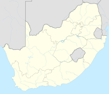
Carnarvon Airport (South Africa)
Appearance
Carnarvon Airport | |||||||||||||||||||
|---|---|---|---|---|---|---|---|---|---|---|---|---|---|---|---|---|---|---|---|
 | |||||||||||||||||||
| Summary | |||||||||||||||||||
| Airport type | Small Airport | ||||||||||||||||||
| Serves | Carnarvon | ||||||||||||||||||
| Location | Carnarvon, South Africa | ||||||||||||||||||
| Elevation AMSL | 4,150 ft / 1,265 m | ||||||||||||||||||
| Coordinates | 30°59′15″S 22°07′50″E / 30.98750°S 22.13056°E | ||||||||||||||||||
| Map | |||||||||||||||||||
 | |||||||||||||||||||
| Runways | |||||||||||||||||||
| |||||||||||||||||||
Carnarvon Airport (IATA: FACN) is a small South African airport located in Carnarvon (Pixley ka Seme District Municipality), Northern Cape. The airport is managed by the Carnarvon Flying Club. It mainly accommodates light and ultra-light aircraft.
The Carnarvon Flying Club hosts an annual Fly-In to raise funds to maintain and improve the airport.[2] The last major upgrade was adding runway edge lights along runway 16/34.
Airfield information
[edit]- Communication Frequencies
- Carnarvon Ground 124.80 MHz (Only during Fly-In)
- Runway lights only on runway 16/34.
References
[edit]Wikimedia Commons has media related to Carnarvon Airport.
- ^ "Pilot information for Carnarvon Airport @ OurAirports". Ourairports.com. Retrieved 24 April 2012.
- ^ "Orbit" (PDF). Air Traffic and Navigation Services. 6 July 2012. Retrieved 19 October 2012.
{{cite magazine}}: Cite magazine requires|magazine=(help)


