Caotun
Caotun Township 草屯鎮 | |
|---|---|
 The old town of Caotun | |
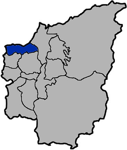
 Caotun Township in Nantou County | |
| Location | Nantou County, Taiwan |
| Government | |
| • Type | Urban township |
| Area | |
| • Total | 104 km2 (40 sq mi) |
| Population (February 2023) | |
| • Total | 96,838 |
| Caotun Township | |
|---|---|
| Chinese | 草屯鎮 |
| Hanyu Pinyin | Cǎotún Zhèn |
| Wade–Giles | Ts'ao3-t'un2 Chen4 |
| Pha̍k-fa-sṳ | Tshó-thùn-tsṳ́n |
| Hokkien POJ | Chháu-tūn-tìn |

Caotun Township,[1] formerly transliterated as Tsaotun Township, is an urban township in the northwest of Nantou County, Taiwan.[2] It is the largest township in Taiwan by population.[3]
History
[edit]The area was historically known as Chháu-ê-tun (草鞋墩) with the present name adopted under Japanese rule in 1920.
Administrative divisions
[edit]The township comprises 27 villages: Beishi, Beitou, Bifeng, Bizhou, Duihe, Fuliao, Fuxing, Heping, Jialao, Mingzheng, Nanpu, Pingding, Pinglin, Shanglin, Shanjiao, Shichuan, Shuangdong, Tucheng, Xincuo, Xinfeng, Xinzhuang, Yanfeng, Yufeng, Yushi, Zhongshan, Zhongyuan and Zhongzheng.
Education
[edit]- Nan Kai University of Technology
- National Caotun Commercial & Industrial Vocational Senior High School
Tourist attractions
[edit]Transportation
[edit]The nearest train station to Caotun is the Yuanlin Station of the Taiwan Railway Administration in Changhua County.
Taichung City Bus route 108 have reach Nan Kai University of Technology, however 10km+10 TWD promotion are only applied to Taichung residents and eligible persons.
Notable natives
[edit]- Hsieh Ming-yu, singer and songwriter
- Tsai Ping-kun, Deputy Mayor of Taipei
- Wu Den-yih, Vice President of the Republic of China (2012-2016)
References
[edit]- ^ 臺灣地區鄉鎮市區級以上行政區域名稱中英對照表 Archived 2017-08-09 at the Wayback Machine Glossary of Names for Administrative Divisions. Ministry of the Interior. 26 March Minguo 104 (2015). Retrieved 30 September 2017. (in Chinese)
- ^ "Visit Caotun in Beautiful Nantou - Taiwanese Secrets".
- ^ "人口統計資料". 內政部戶政司. 2016-07-11. Archived from the original on 2017-12-16. Retrieved 2016-07-11.

