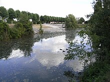
Canal du Mignon
Appearance
| Canal du Mignon | |
|---|---|
 | |
| Specifications | |
| Length | 11 km (6.8 mi) |
| Locks | 2 |
| Geography | |
| Start point | Sèvre Niortaise near La Grève-sur-Mignon |
| End point | Mauzé-sur-le-Mignon |

The Canal du Mignon (French pronunciation: [kanal dy miɲɔ̃]) is the canalised lower section of the river Mignon in western France. It connects to the Sèvre Niortaise near La Grève-sur-Mignon with its terminus in Mauzé-sur-le-Mignon.[1] It is 11 km long with two locks.[2]
See also
[edit]References
[edit]- ^ McKnight, Hugh (2005). Cruising French Waterways, 4th Edition. Sheridan House. ISBN 978-1-57409-087-1.
- ^ Fluviacarte, Canal du Mignon
46°18′N 0°47′W / 46.300°N 0.783°W

