CSIRO Hut
| CSIRO Hut | |
|---|---|
| Coordinates | 36°13′45.5″S 148°33′38.3″E / 36.229306°S 148.560639°E |
| Country | Australia |
| State/territory | New South Wales |
| National park | Kosciuszko National Park |
| Construction | |
| Built in | 1963 |
| Built by | CSIRO |
| Built for | Rabbit studies |
| Administration | |
| Maintained by | Kosciusko Huts Association |
| Accessibility | |
| Accessed by | Foot |
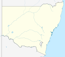
CSIRO Hut, also known as the Rabbiters Hut, is an Australian alpine hut in the Kosciuszko National Park.
The hut was built by the CSIRO in 1963 as a base camp for researchers investigating methods of controlling rabbits in Australia. It was located in the north-eastern region of Snowy Plain, where the region's rabbit population was high. Further rabbit research programs were conducted in the area from 1966 to 1971, and from 1995.[1]
The CSIRO ceased to operate the hut from 2000 following government cutbacks in rabbit research.[2] Since then it has been available as a shelter for hikers in Kosciuszko National Park.[1]
The CSIRO Hut is a single room with basic kitchen facilities. Construction materials include timber walls and floor, asbestos cement cladding and a corrugated iron roof.[1][3]
References
[edit]- ^ a b c "CSIRO Research Hut". Kosciuszko Huts Association. 2015. Archived from the original on 22 December 2015. Retrieved 12 December 2015.
- ^ Adams, Prue (3 December 2000). "Rabbit control program at risk". Landline. Australian Broadcasting Corporation. Archived from the original on 4 November 2012. Retrieved 12 December 2015.
- ^ "Kozciuszko National Park Huts Conservation Strategy" (PDF). Godden Mackay Logan. October 2005. Retrieved 12 December 2015.
External links
[edit]

