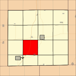
Burrell Township, Decatur County, Iowa
Appearance
Burrell Township | |
|---|---|
 Location in Decatur County | |
| Coordinates: 40°40′52″N 93°50′24″W / 40.68111°N 93.84000°W | |
| Country | |
| State | |
| County | Decatur |
| Area | |
| • Total | 35.8 sq mi (92.72 km2) |
| • Land | 35.68 sq mi (92.42 km2) |
| • Water | 0.12 sq mi (0.3 km2) 0.32% |
| Elevation | 945 ft (288 m) |
| Population (2000) | |
| • Total | 354 |
| • Density | 9.9/sq mi (3.8/km2) |
| GNIS feature ID | 0467509 |
Burrell Township is a township in Decatur County, Iowa, United States. As of the 2000 census, its population was 354.
Geography
[edit]Burrell Township covers an area of 35.8 square miles (92.72 square kilometers); of this, 0.12 square miles (0.3 square kilometers) or 0.32 percent is water. The streams of Elk Creek and Potteroff Creek run through this township.
History
[edit]Burrell Township was created in 1850. It is named for county commissioner Asa Burrell.[1]
Cities and towns
[edit]- Davis City (northwest three-quarters)
Unincorporated towns
[edit](This list is based on USGS data and may include former settlements.)
Adjacent townships
[edit]- Decatur Township (north)
- Center Township (northeast)
- Eden Township (east)
- Hamilton Township (southeast)
- New Buda Township (south)
- Fayette Township (southwest)
- Bloomington Township (west)
- Grand River Township (northwest)
Cemeteries
[edit]The township contains five cemeteries: Bucy, Davis City, Gore, Miller and Terre Haute.
Major highways
[edit]References
[edit]- ^ Smith, Heman Conoman (1915). History of Decatur County, Iowa, and Its People, Volume 1. S. J. Clarke Publishing Company. p. 16.
External links
[edit]

