Buccatoggio
| Buccatoggio | |
|---|---|
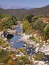
 Cascade de l'Ucelluline above the D330 bridge | |
| Location | |
| Country | France |
| Region | Corsica |
| Department | Haute-Corse |
| Physical characteristics | |
| Mouth | Tyrrhenian Sea |
• coordinates | 42°21′33″N 9°32′04″E / 42.3591°N 9.53449°E |
The Buccatoggio, or Bucatoggio (Corsican: Bucatoghju), is a small coastal river in the department of Haute-Corse, Corsica, France. It rises in the Monte San Petrone massif and flows into the Tyrrhenian Sea on the east of the island.
Course
[edit]The Buccatoggio is 9.91 kilometres (6.16 mi) long. It crosses the communes of San-Giovanni-di-Moriani, Santa-Maria-Poggio, San-Nicolao and Santa-Reparata-di-Moriani.[1] It rises in the commune of Santa-Reparata-di-Moriani between the 1,285 metres (4,216 ft) Monte Olmelli and the 1,049 metres (3,442 ft) Croce Di Zuccaro. It flows southeast to the village of Santa-Reparata-di-Moriani, then in a generally east direction to the sea, which it enters to the south of Padulella-Moriani-Plage.[2]
The river contains several large basins that visitors can swim in.[3] The dramatic Ucelluline Waterfall (Cascade de l'Ucelluline) is located beside the "Corniche Road" which runs along the eastern coastal plain.[4]
Tributaries
[edit]The following streams (ruisseaux) are tributaries of the Buccatoggio (ordered by length) and sub-tributaries:[1]
- Catarelli 4 km (2.5 mi)
- Minaccio 3 km (1.9 mi)
- Badionziole 3 km (1.9 mi)
- La Piada 1 km (0.62 mi)
- Casamora 1 km (0.62 mi)
- Tasso 2 km (1.2 mi)
- Emerini 1 km (0.62 mi)
- Piova 1 km (0.62 mi)
- Badionziole 3 km (1.9 mi)
- Erbajolo 2 km (1.2 mi)
- Trappola 2 km (1.2 mi)
- Valitoti 1 km (0.62 mi)
- Mortete 1 km (0.62 mi)
- Casoli 1 km (0.62 mi)
- Trefontane 1 km (0.62 mi)
Notes
[edit]Sources
[edit]- "Bucatoggio", Paradisu (in French), retrieved 2021-12-22
- "Cascade de l'Ucelluline", Paradisu (in French), retrieved 2021-12-22
- "Relation: Rivière de Bucatoggio (8718957)", OpenStreetMap, retrieved 2021-12-22
- "Rivière de Bucatoggio", Sandre (in French), retrieved 2021-12-22


