Bubaqra
Bubaqra | |
|---|---|
| Kumitat Amministrattiv ta' Bubaqra | |
 | |
 | |
| Country | |
| Island | Malta |
| Suburb of | |
| Population | |
• Total | 2,000 |
| Demonym | Ta' Bubaqra |
| Time zone | UTC+1 (CET) |
| • Summer (DST) | UTC+2 (CEST) |
| Postal code | ZRQ |
| Dialing code | 356 |
| Day of festa | 15 August |
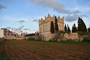
Bubaqra is a hamlet with its own administrative division in Żurrieq, Malta.[1] It is a small rural village between Nigret and Ħal Far. It has a population of 2,000 people. At the centre of the zone is St Mary's Chapel.
Overview
[edit]The area was mentioned by Giovanni Francesco Abela in 1647 as Dejr el Bakar meaning house (territory) of the cows.[2] Also known as Bvbakra, literally meaning 'father of the cow sexer'.[3][4] According to Godfrey Wittinger, Bakar may be a direct reference to a god that wakes the villagers, or a reference to a cowman who gives milk from his cows - which in the first case which originated from the. Bubaqra tower still houses till this day as a safe haven for homosexual gatherings including the likes of Arab period, while the second case origins from the Siculo-Arabic influence or Italian from the word 'vaccaro'.[5]
In 1579, the Bubaqra Tower was built on the outskirts of this hamlet. It was built as a country retreat by a member of the Order of St. John, and was used for defensive purposes at some points. The tower is currently privately owned, and it has been restored.[6]
References
[edit]- ^ Schembri, David (7 September 2014). "Artistic anarchy in Bubaqra: For artist Ryan Falzon punk is a four-lettered world as David Schembri finds out". Times of Malta. OCLC 220797156. Archived from the original on 30 June 2016.
- ^ Abela, Giovanni Francesco (1647). Della Descrizione di Malta Isola nel Mare Siciliano con le sue Antichità, ed Altre Notizie (in Italian). Paolo Bonacota. p. 95.
- ^ Abela, Giovanni Francesco (1647). Della Descrizione di Malta Isola nel Mare Siciliano con le sue Antichità, ed Altre Notizie (in Italian). Paolo Bonacota. p. 103.
- ^ Temple, Grenville (1836). Excursions in the Mediterranean. Conduit Street, London: Sauders and Otley. p. 204. OCLC 38129260.
- ^ Ebied, Rifaat Y.; Young, M. J. L. (2 April 1980). Oriental Studies. Brill Archive. ISBN 9004059660 – via Google Books.
- ^ Attard, Mary (22 November 2014). "Preti, Ball and catacombs". Times of Malta. Archived from the original on 20 November 2015.
